Skip to Content

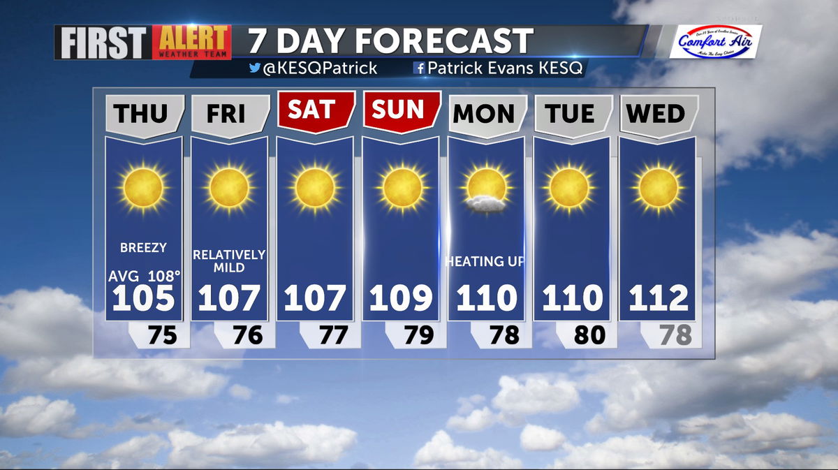
Breezy and More Comfortable Today

An area of low pressure swinging through California to our North will enhance local winds and increase the Marine Layer, bringing cooler temps to the region for a few days.

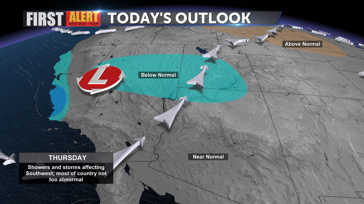
Because of the onshore flow, the deeper Marine Layer will cover portions of Coastal and Inland California going into the weekend, which will keeps highs slightly below seasonal norms.

The outlook through next week sees highs slowly returning to 110 or better, but not until Monday and Tuesday.

Article Topic Follows: Local Forecast

Jump to comments ↓

Author Profile Photo

Patrick Evans

Patrick Evans is the News Channel 3’s morning and noon meteorologist, and Host of Eye on the Desert. Patrick also hosts afternoon drive on 103.1 MeTV FM. Learn more about Patrick here.

BE PART OF THE CONVERSATION

News Channel 3 is committed to providing a forum for civil and constructive conversation.

Please keep your comments respectful and relevant. You can review our Community Guidelines by clicking here

If you would like to share a story idea, please submit it here.

Skip to content