A fantastic Friday for the desert
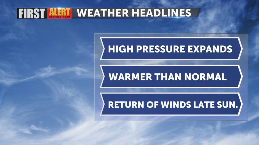
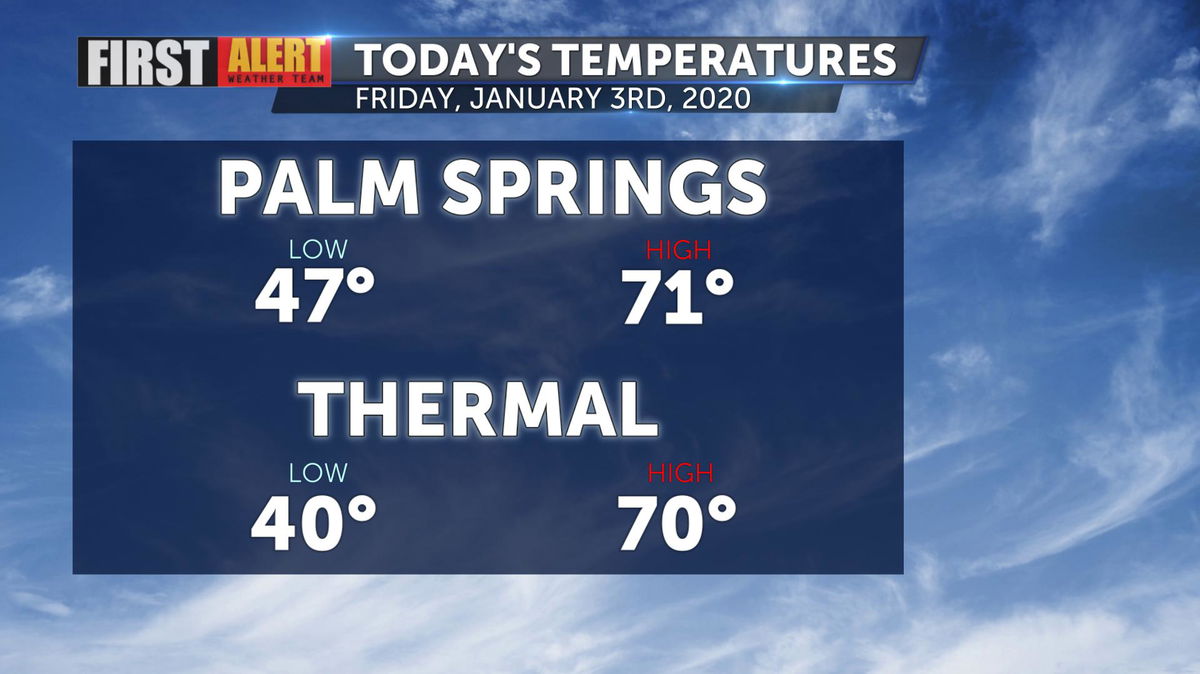
Above normal temperatures were felt once again today, although Palm Springs was three degrees cooler than Thursday. An average high for today's date is 67°.
A ridge of high pressure is responsible for the warmer start to the New Year but it's lifespan is short lived. The ridge will become flattened over the weekend as a trough develops to the north.

Temperatures will remain consistent for the next few days ahead but further cooling will take place by the middle of next week.

One big change up for the start of the work week will be gusty offshore winds as a Santa Ana pattern sets up. A High Wind Watch goes into effect Sunday evening and remains through Tuesday morning for local mountains, including the San Gorgonio Pass.
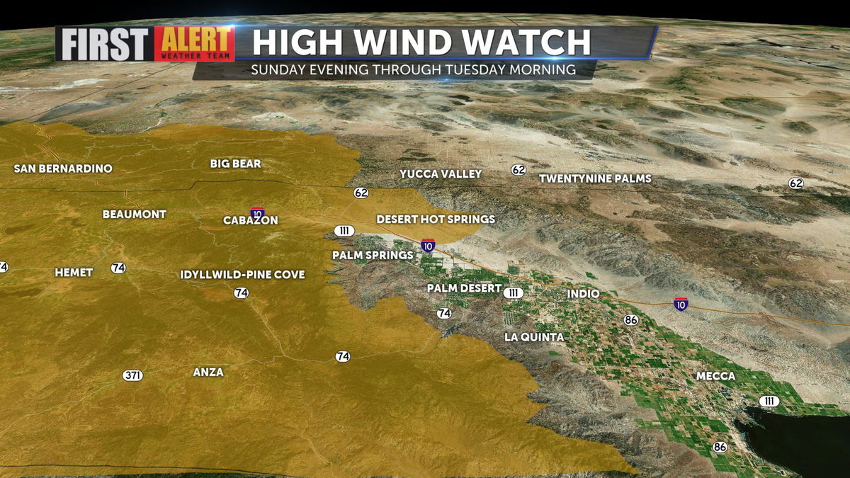
Gusts along mountain communities will peak 40-50 mph, while the lower desert will keep gusts closer to 25 mph.
