Major Changes ahead this Week
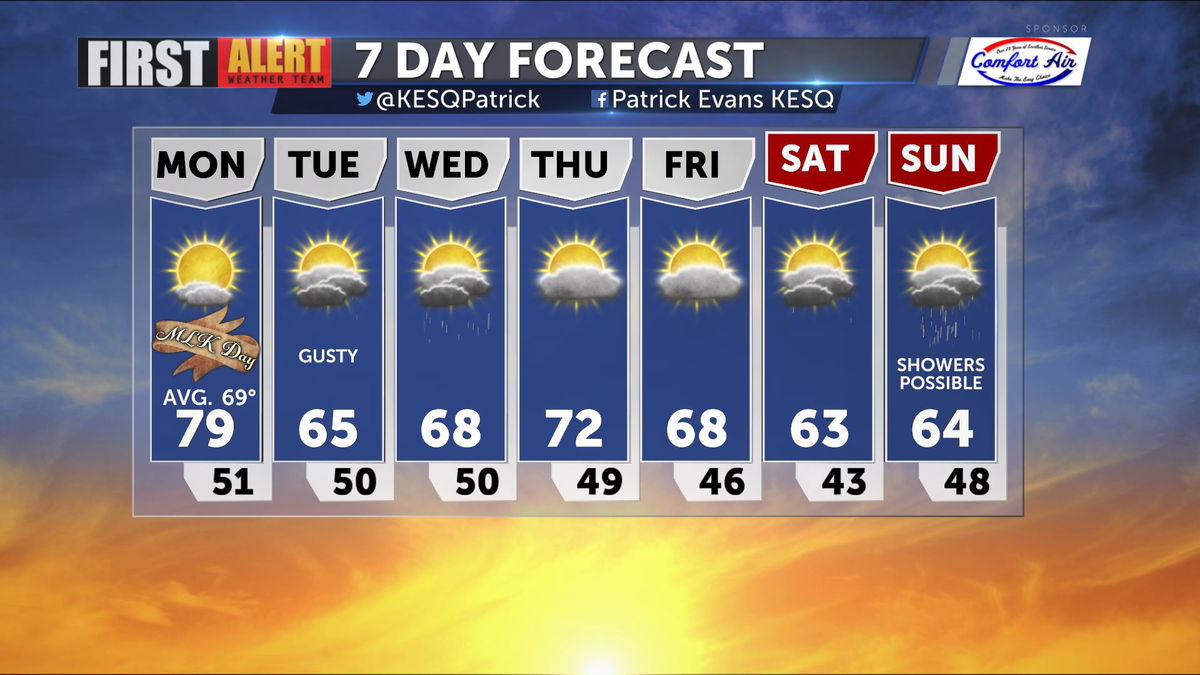
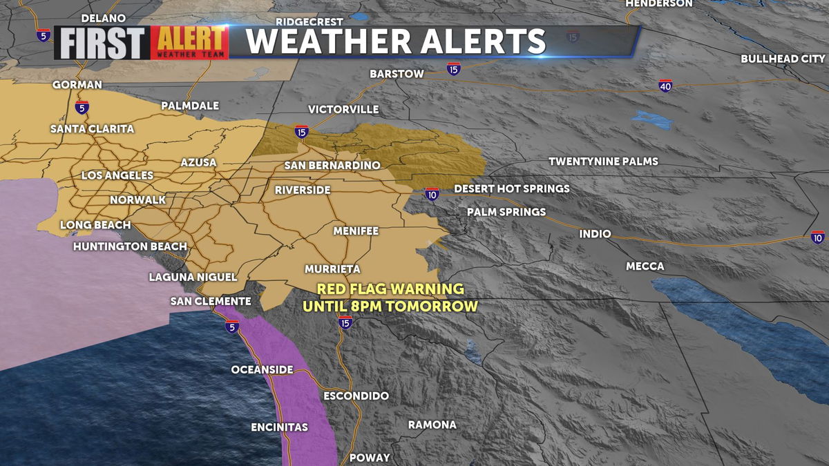
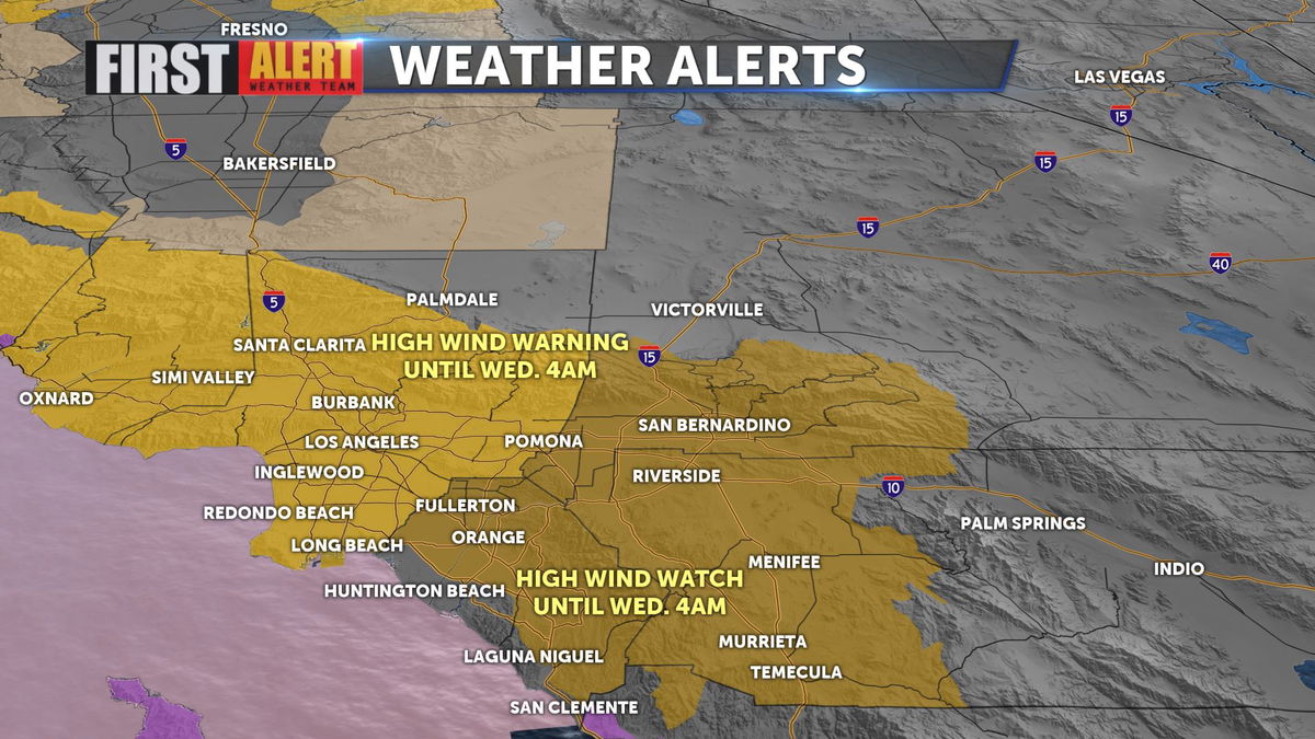
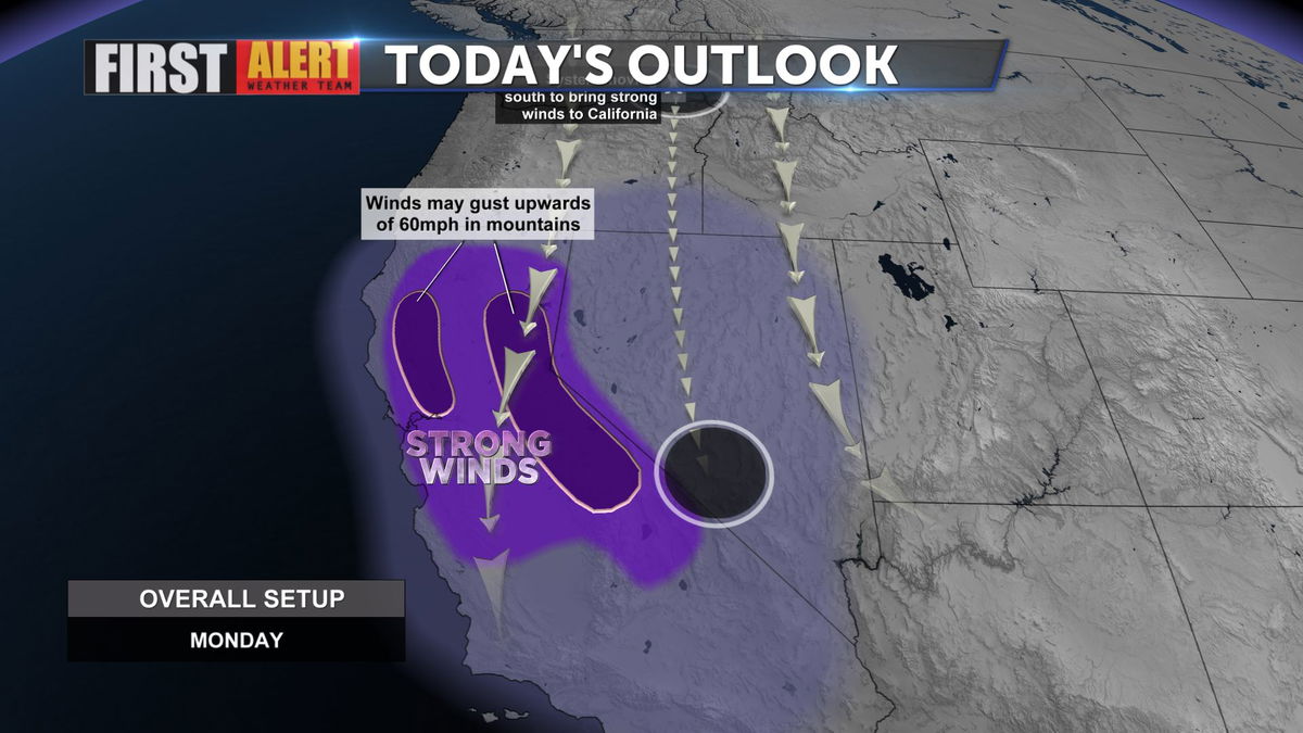
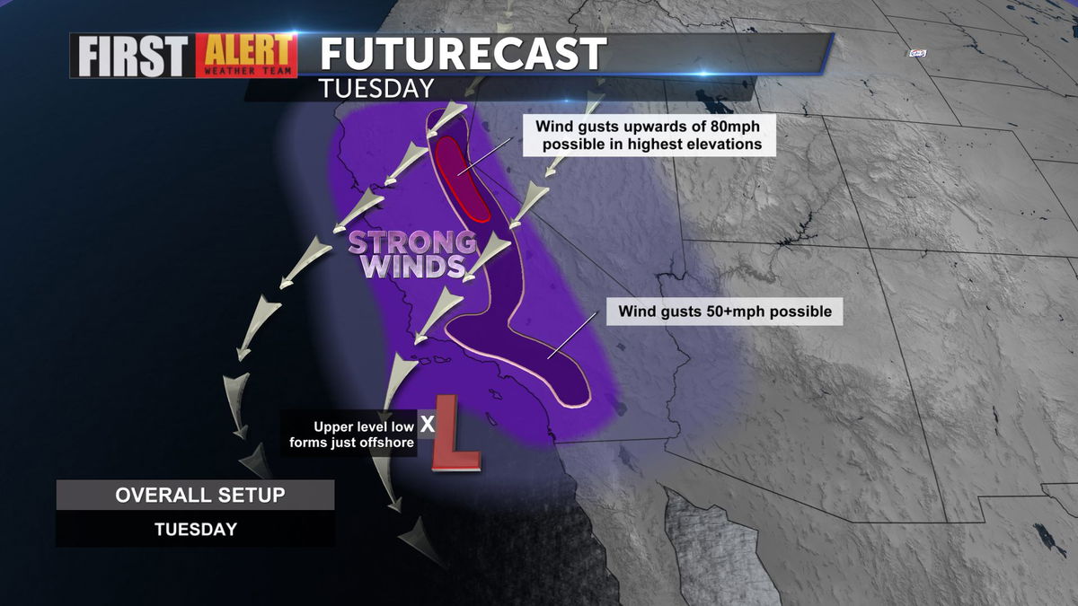
The warm records of the weekend are behind us, and now winter returns. Today will be a day of transition. Expect highs near 80, but gusty winds will develop this afternoon and evening. High Wind Watches and Warnings will go into effect for areas to our West later today, along with a Red Flag Warning still in effect until tomorrow for the mountains and Inland Empire.
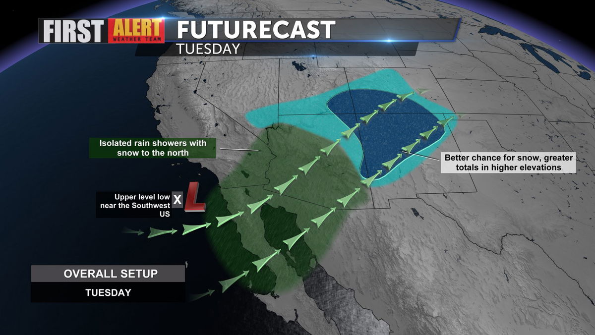
The low pressure center will drop into SoCal bringing much cooler weather starting tomorrow as highs dip into the sixties for a few days, along with a 20% of showers in the Coachella Valley. As the low approaches winds will be the biggest factor in our forecast.
Into Tuesday night and Wednesday, showers may develop but will be minimal in terms of total precipitation. Winds will remain gusty through the period.
In addition to light rainfall, some snow is possible at resort levels in our local mountains, but again, not a great deal of accumulation.
From Tuesday through the weekend, we'll see markedly cooler daytime highs, and another small chance of showers develops into the weekend.