A couple of rounds of rain possible
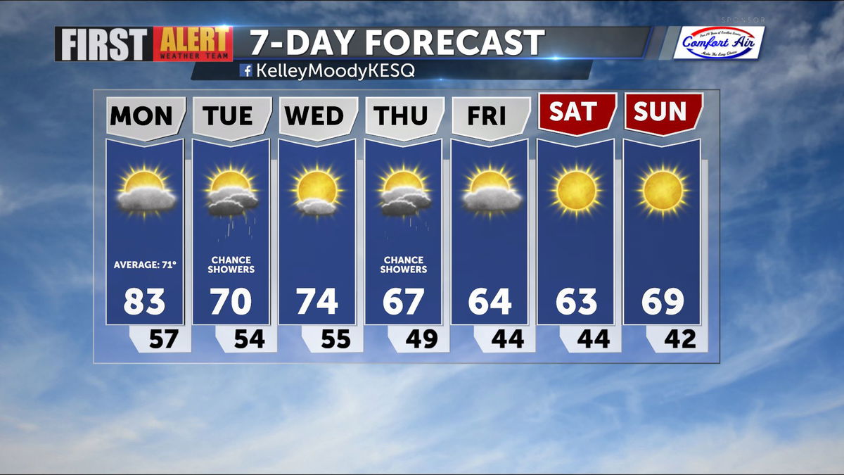
Our long stretch of warm and dry conditions may come to a close this next week. While we maintain warm and dry conditions this Sunday, changes are headed our way.
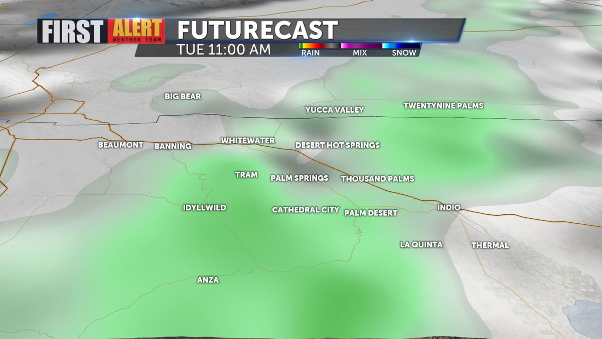
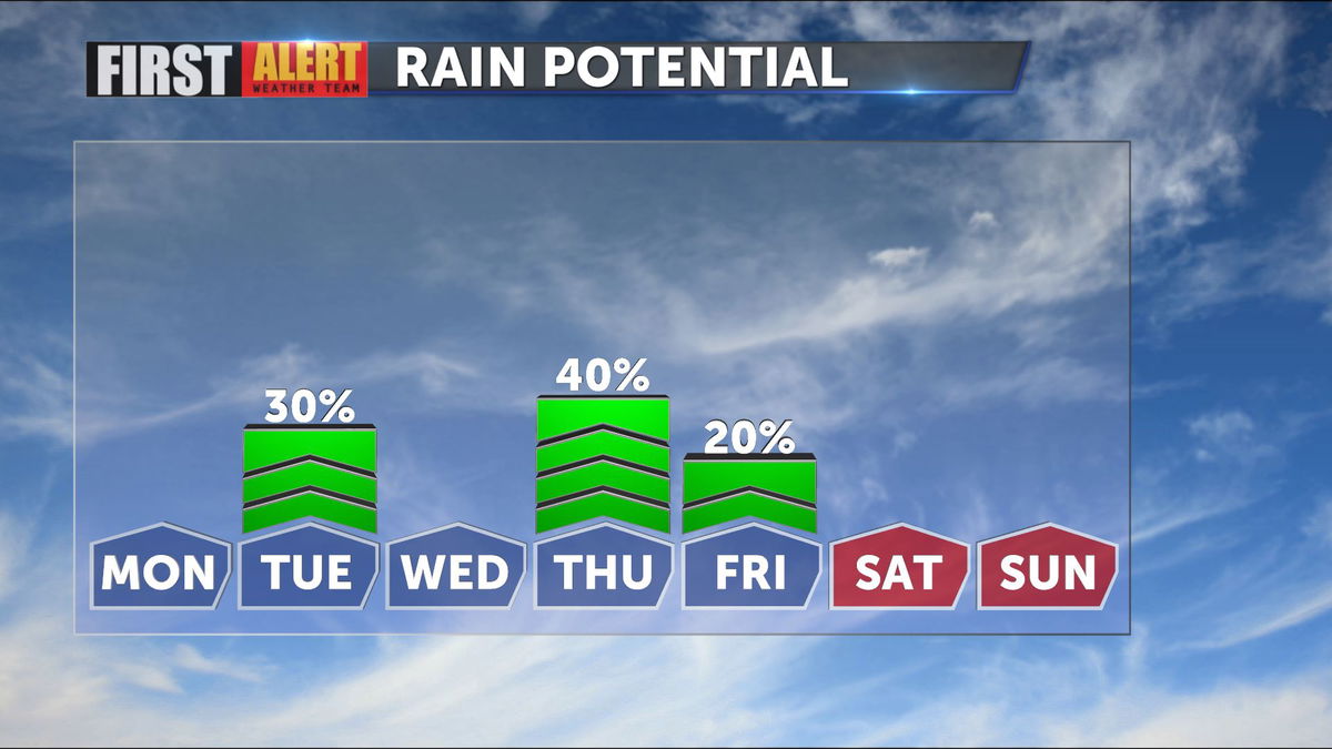
Temperatures will drop to the low 80s for Monday with more cloud cover overhead. This is in preparation for Tuesday's potential light showers. The highest impact looks to be in the morning hours with limited accumulation, under a tenth of an inch for most areas.
We will have another chance for rain as we look toward the later half of the week. Thursday into early Friday offers higher confidence for widespread precipitation and higher accumulation values.
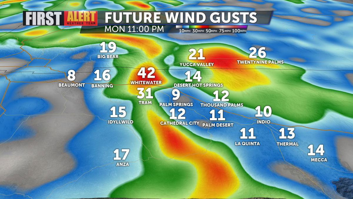
Expect increasing onshore flow with winds, especially on Monday evening. Gusts could be upwards of 40 mph for the San Gorgonio Pass, with light winds on the valley floor. These winds will deliver cooler, more seasonable temperatures.
Temperatures continue to fall to the lower end of the 60s through Saturday.