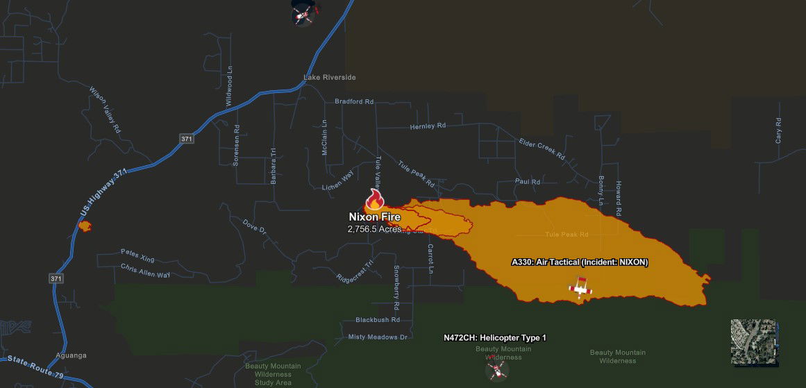
Nixon Fire: 5,222 acres, 30% containment, cause of fire discovered
8/2 at 7 p.m. UPDATE: According to Cal Fire, the Nixon fire remains at 5,222 acres and is now 30% contained.
The evacuation center at Temecula Valley High School is closed and the evacuation center is now available at Hamilton High School, 57430 Mitchell Road, Anza.
8/2 at 4 p.m. UPDATE: Cal Fire Law Enforcement has concluded the cause of the Nixon Fire, which is still burning at 5,222 acres.
“CAL FIRE Peace Officers, after an origin and cause investigation, determined that the cause of the fire was electrical and caused by a privately owned electrical panel,” stated CAL FIRE Law Enforcement Officials.
8/2 at 8 a.m. UPDATE: Cal Fire shared that the Nixon Fire has reached 5,222 acres, and is 21% contained. "Overnight, the fire has moderated and strong work by firefighters has kept the fire within the existing perimeter," the statement reads. "Crews continue to construct and reinforce containment lines around the fire. The monsoonal weather pattern may produce lightning and increased winds, creating potential for increased fire activity."
For more information and updates on the fire, click here.
8/1 at 9 a.m. UPDATE: The fire is now mapped at 5,192 and is 14% contained, Cal Fire confirmed. Crews saw minimal activity brewing overnight. Cal Fire said "interior pockets of fuel" will continue to burn over the next few days while firefighters gain control. Due to monsoonal weather, moisture will increase through Friday, with a chance of producing thunderstorms and lightening.
7/31 at 7 p.m. UPDATE: According to Cal Fire, the Nixon fire is still mapped at 4,941 acres and is now 8% contained.
#NIXONFIRE [UPDATE 7/31/24 at 7 p.m.] The fire remains mapped at 4,941 acres and is 8% contained.
— CAL FIRE/Riverside County Fire Department (@CALFIRERRU) August 1, 2024
The Nixon fire experienced moderate weather throughout the day. Crews continue to go direct with handline construction and hose lays on the southeast portion of the fire towards the… pic.twitter.com/8EwghNYG6c
7/31 at 8 a.m. UPDATE: The fire is now 5% contained, acreage remains 4,941.
NIXON FIRE Morning Operational Update with Operations Section Chief Bennett pic.twitter.com/s6S38u4NdY
— CAL FIRE/Riverside County Fire Department (@CALFIRERRU) July 31, 2024
7/30 at 7 p.m. UPDATE: The Nixon fire is now mapped at 4,941 acres and remains at 0% containment.
According to Cal Fire, the fire displayed moderate fire activity and continued to burn to the south and east, adjacent to the San Diego County line and the Beauty Mountain Wilderness in steep and rugged terrain.
Firefighters will continue to work throughout the night within the fire's footprint, focusing on building direct line and improving containment while maintaining structure defense to safeguard the residents of Aguanga.
All evacuation orders and warnings will remain in place. Evacuation warnings have also been placed in San Diego County for zones SDC-0048, SDC-0076, SDC-0077, SDC-0078, SDC-0079, SDC-0080, SDC-0081.
7/30 at 2:30 p.m. UPDATE: The fire has reached 4,500 acres and remains 0% contained, according to Cal Fire. One structure is fully destroyed, and four other structures are damaged.
7/29 at 9:30 p.m. UPDATE: The fire has grown to 3,700 acres and remains at 0% containment according to Cal Fire.
7/29 at 7 p.m. UPDATE: Cal Fire reports that the fire has grown to 2,700 acres and remains 0% contained.
All evacuation orders and warnings remain in place.
7/29 at 5 p.m. UPDATE: Cal Fire now reports that the fire is 1,000 acres and 0 percent contained.
A wind-driven brush fire that erupted Monday south of Highway 371 in Aguanga scorched an estimated 295 acres and damaged a structure despite the heavy presence of Cal Fire aircraft. The non-injury ``Nixon Fire'' was reported at 12:28 p.m. in the area of Richard Nixon Boulevard and Tule Peak Road, according to the Riverside County Fire Department.
The agency said multiple engine and hand crews from the county, Cal Fire-San Diego County and other agencies were sent to the location and encountered flames burning at a rapid rate to the east through medium brush.
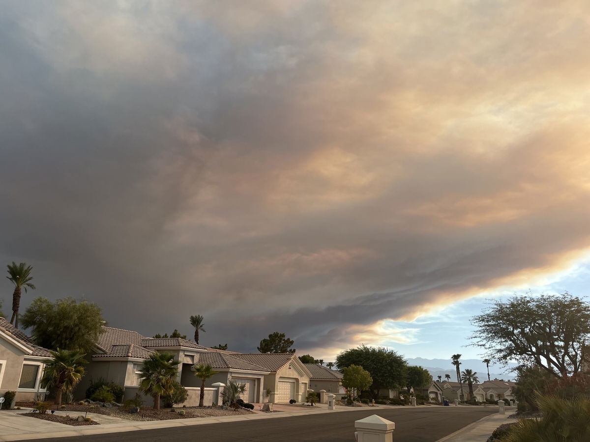
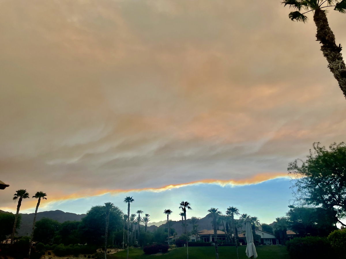
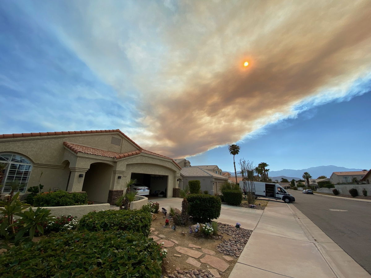
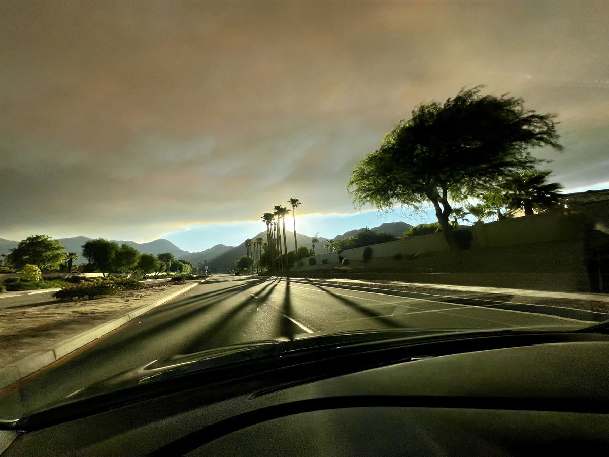
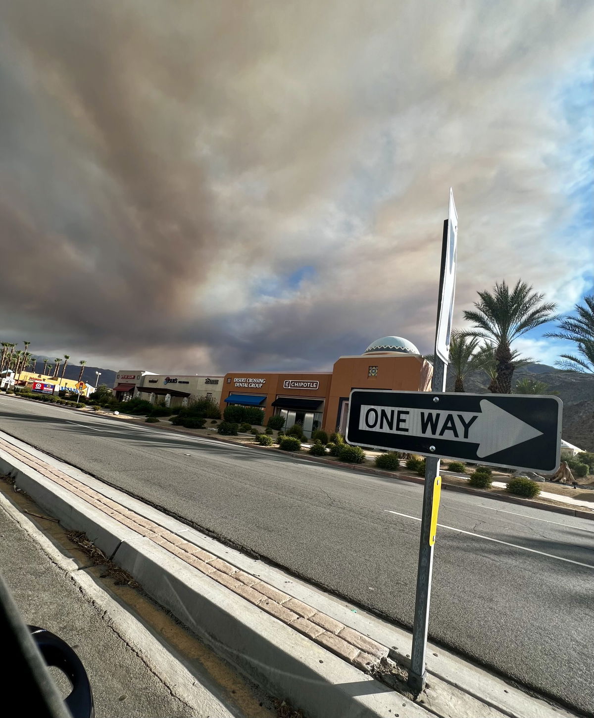
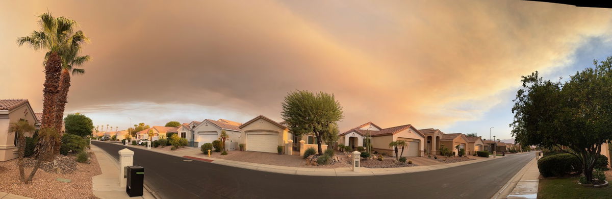
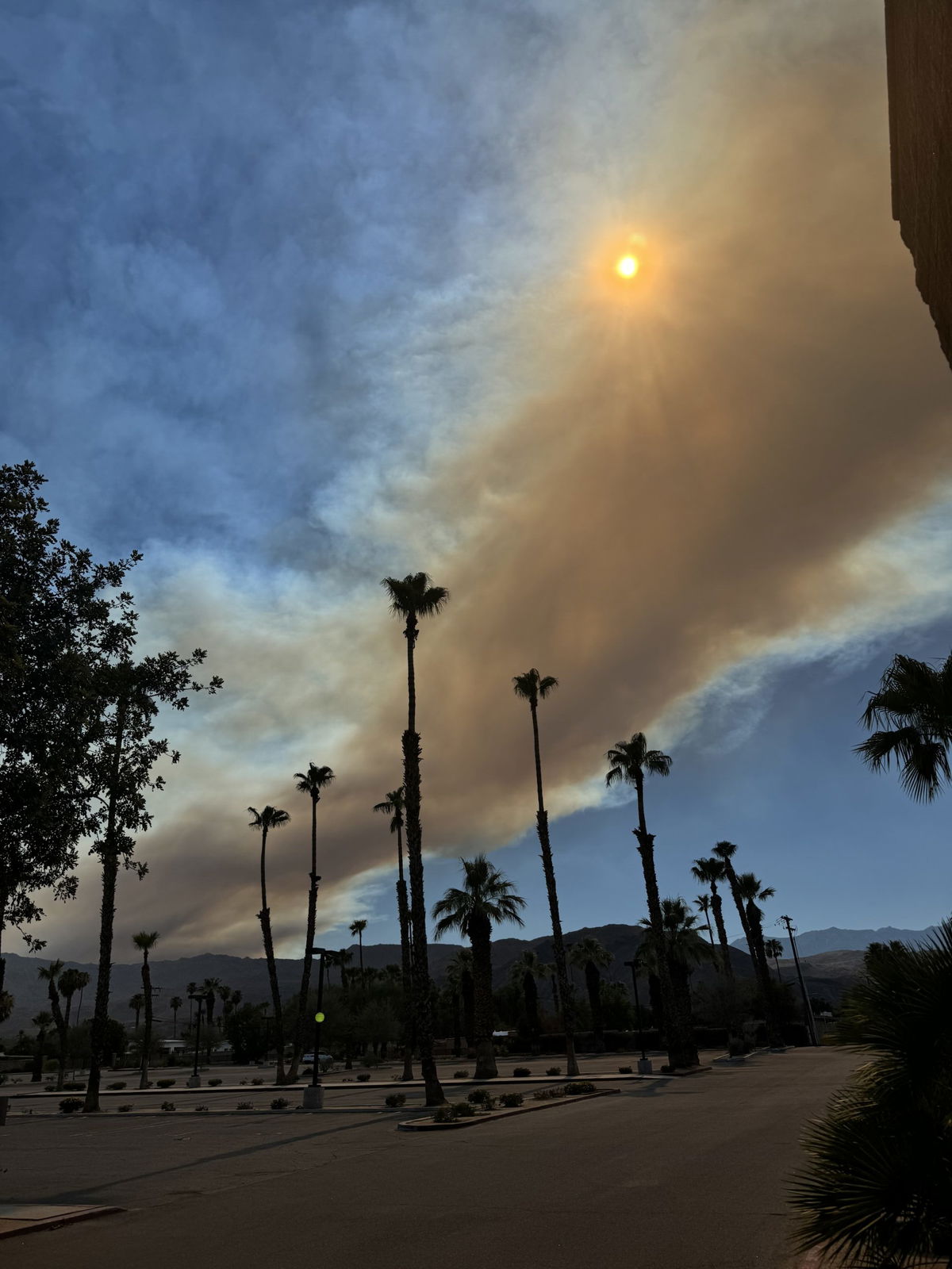
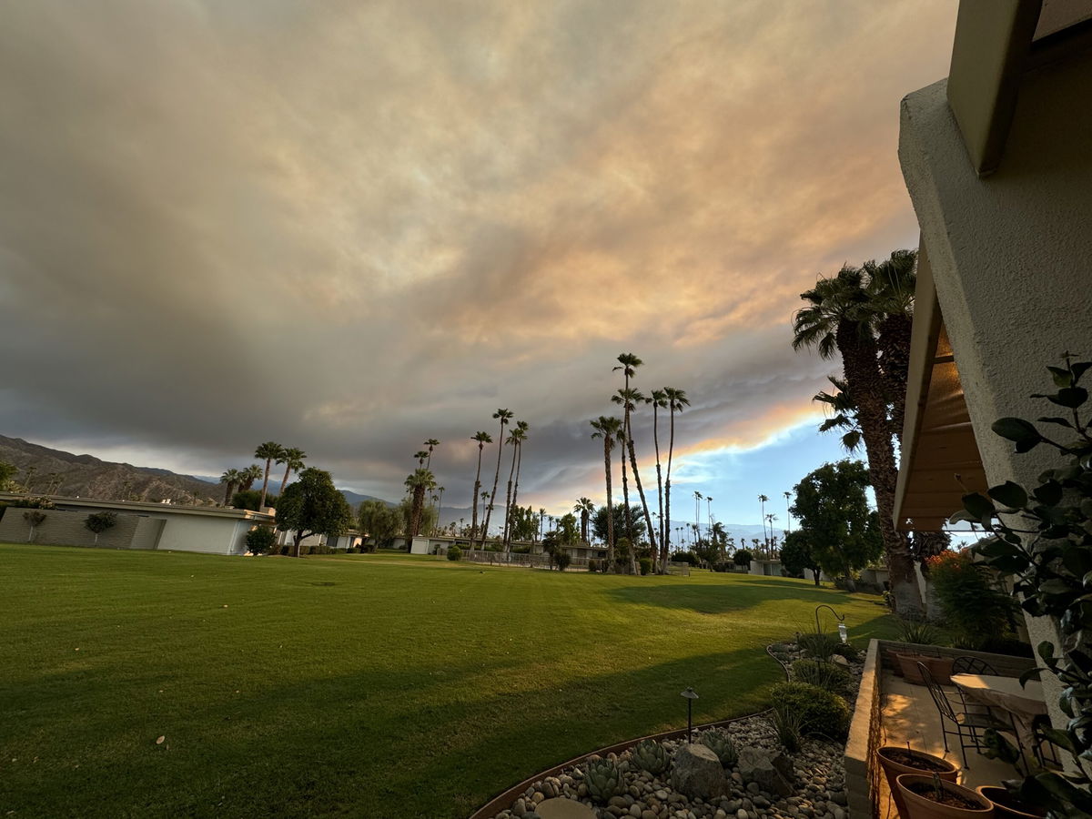
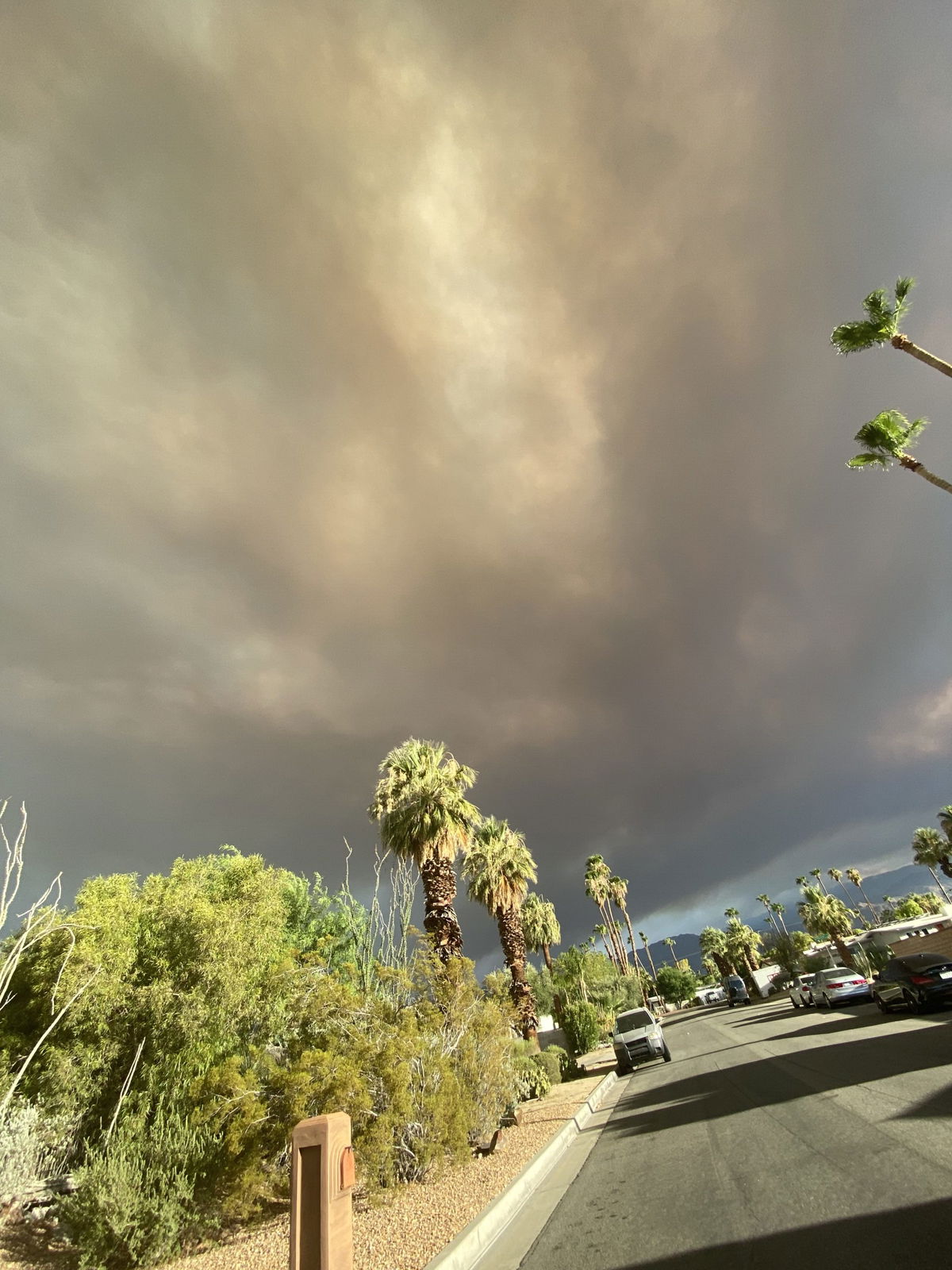
Smoke could be seen in the valley, as the fire sent up large plumes of smoke miles away.
Seven Cal Fire air tankers and four water-dropping helicopters initiated runs on the brusher just before 1 p.m., initially slowing its advance before it accelerated again, according to reports from the scene. The air drops prevented the flames from reaching several houses on Tule Peak. However, at least one outbuilding was consumed. Winds were shifting due to the hilly terrain, complicating firefighting efforts.
Ground crews were spread out, trying to establish structure protection lines. Properties in the remote location are spaced acres apart. An evacuation order was implemented for the scattered homes south of Richard Nixon and east of Tule Peak, and sheriff's deputies were enforcing the order.
Deputies shut down Tule Valley Road south of Tule Peak for public safety. There was no immediate word regarding how the blaze started.
Several viewers shared pictures of the impact the Nixon fire had on the sky tonight in the Coachella Valley: