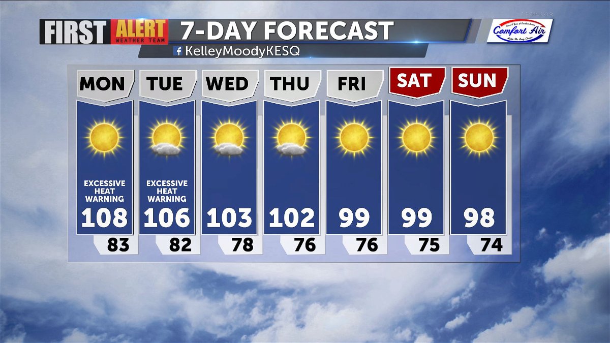
Excessive heat, elevated humidity to start week
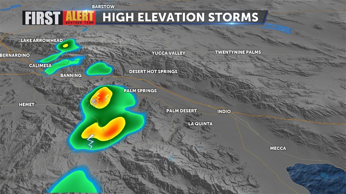
An influx of moisture and above normal temperatures has led to thunderstorm development over areas of higher elevation. Here's a look at radar from around 2:30 p.m.
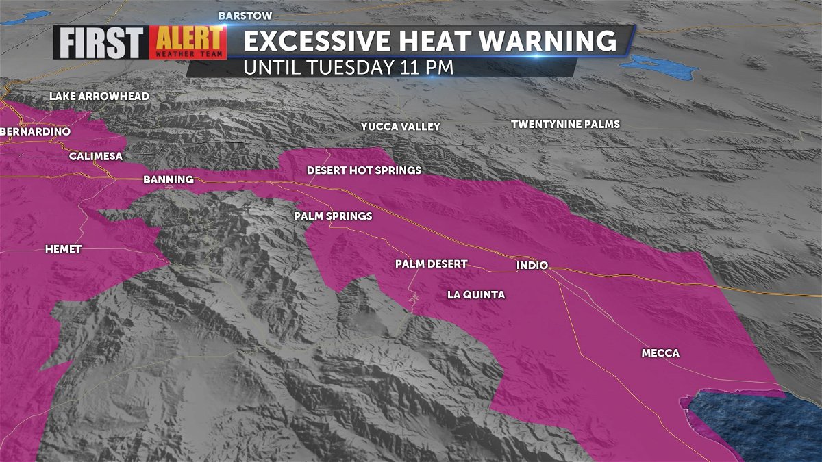
A ridge of high pressure is currently boosting temperatures 5-10° above normal across the region. The National Weather Service has issued an Excessive Heat Warning until Tuesday night at 11 p.m. in response. Rising humidity can also may already warm temperatures feel even warmer than they actually are, but drier conditions are expected over the next few days.
Drier air Monday and Tuesday will limit any possible thunderstorm development. A trough of low pressure approaches Wednesday, bringing down temperatures, but also possibly increasing chances for more precipitation in the mountains. Seasonable temperatures are set to return by the end of the week.