Cal Fire releases revised fire hazard zones for state counties
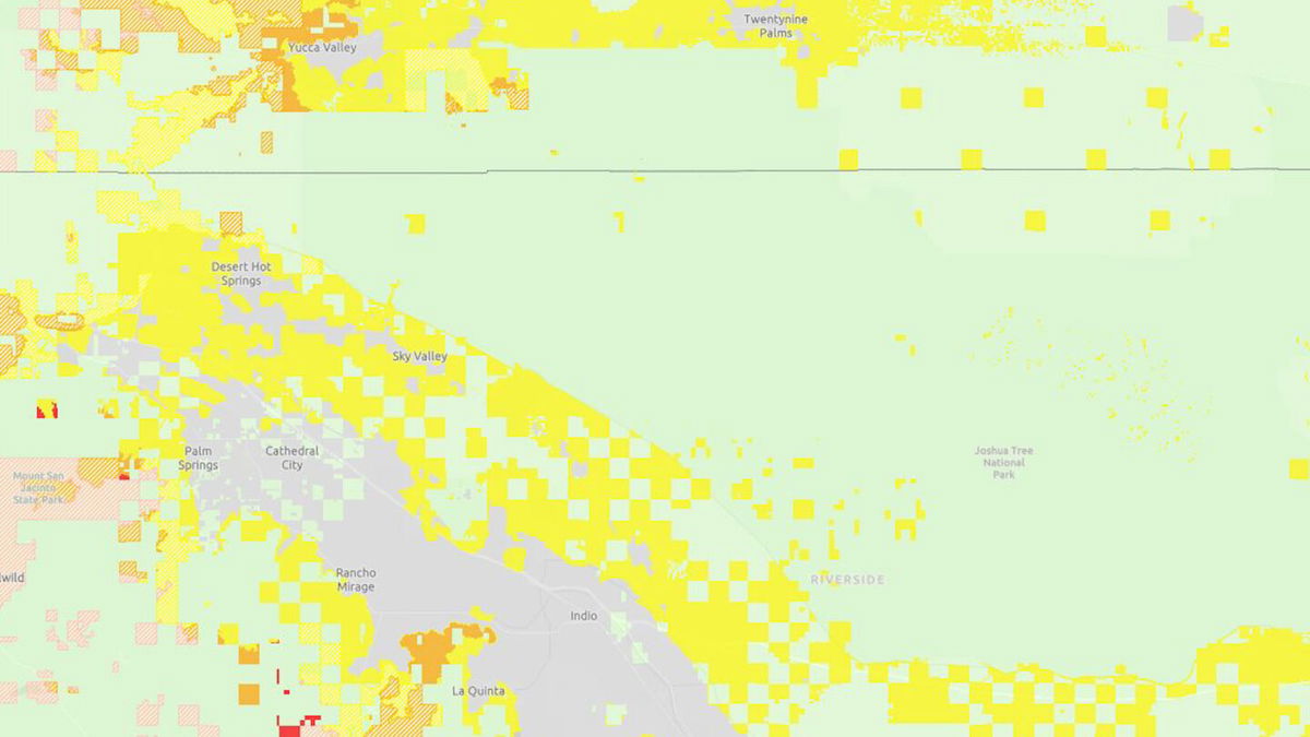
LOS ANGELES (KESQ) - Cal Fire released updated Fire Hazard Severity Zone maps for the state's counties today, using various criteria to identify wildfire hazard areas and ranking them on a three-tiered scale.
The maps, generally updated every decade, can impact building and clearance requirements in areas deemed to be in particular hazard areas.
According to Cal Fire, the determination of "hazard'' is based "on the physical conditions that create a likelihood and expected fire behavior over a 30- to 50-year period, without considering mitigation measures such as home hardening, recent wildfire or fuel reduction efforts.''
Identified hazard zones are divided into three levels -- moderate, high and very high. The determination is made based on a variety of factors, including terrain, fire history, weather patterns and the presence of fire fuels such as thick vegetation.
The Coachella Valley is mostly under the moderate level, with some higher spots around the outskirts of La Quinta and Desert Hot Springs.
Once the hazard zone maps are released by the state, local jurisdictions can adopt them or amend them by increasing the hazard level for particular areas. Local jurisdictions can not reduce the hazard levels from those recommended by the state.
The maps and more information about them are available online at https://osfm.fire.ca.gov/what-we-do/community-wildfire-preparedness-and-mitigation/fire-hazard-severity-zones.