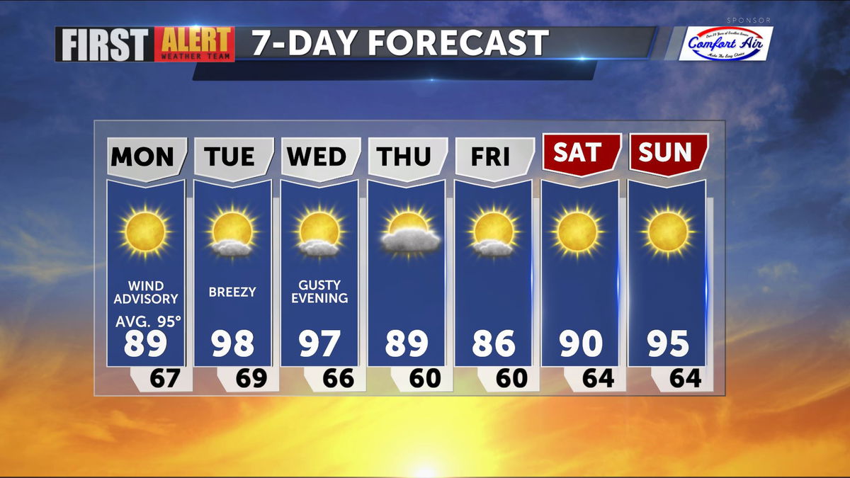
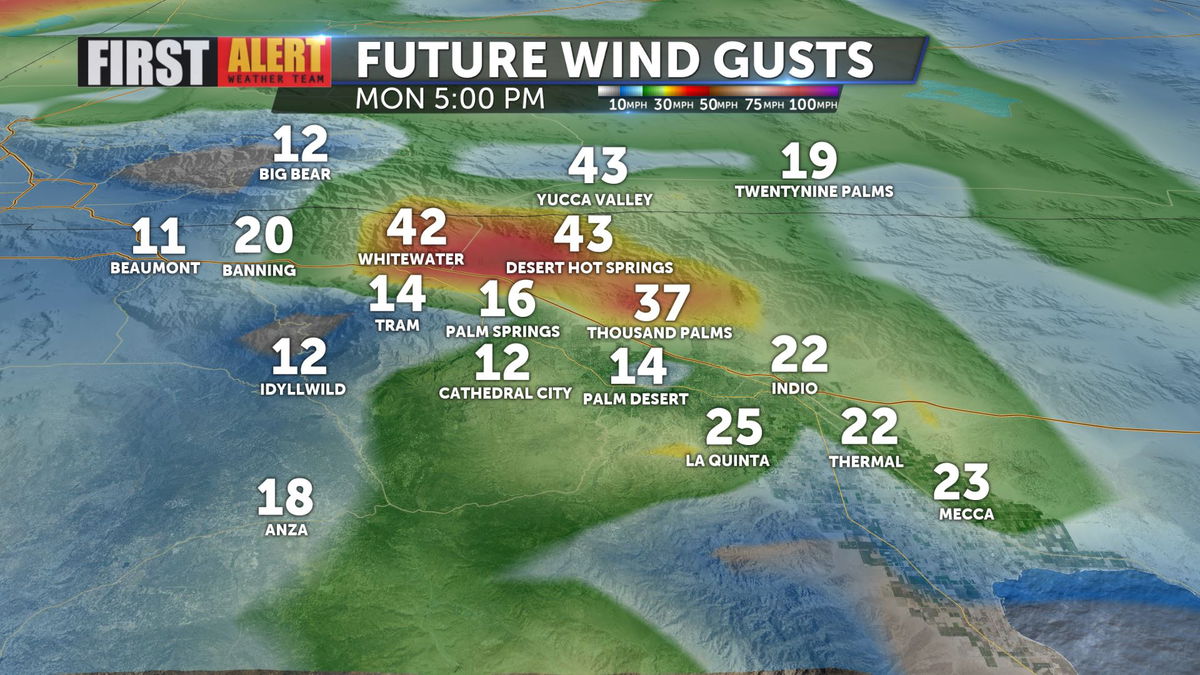
Gusty winds continue into Monday afternoon
Winds of 25-35mpg are still expected even though Wind Advisories for the region have expired.
The winds have also helped dry out the atmosphere, with water vapor decreasing across the region.

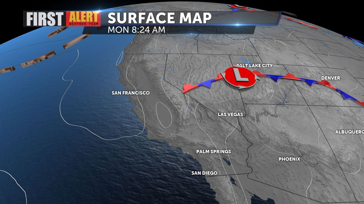
An area of low pressure lingers just south of Salt Lake City, so it will keep the atmosphere churned up a bit with another trough moving late Wednesday.
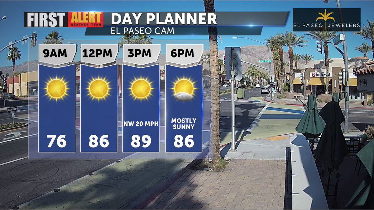
Due to the strong NW winds and cooler air moving in, we'll see highs well below average today.
Highs will climb from the upper 80s today into the 90s for midweek, but another trough drops into NorCal late Wednesday bringing another round of winds and cooler temps to end the week.