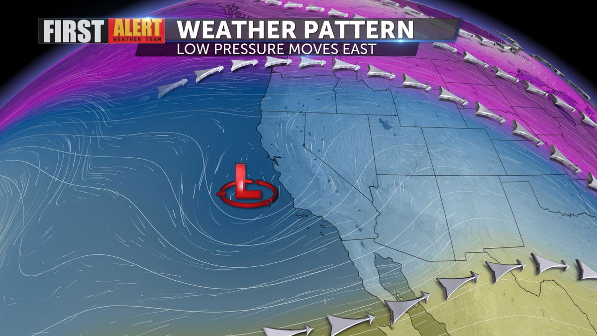
Clouds persist as a low-pressure system moves east
A low-pressure system is moving east today and tomorrow bringing more clouds across Southern California. Still, temperatures warmed into the 70s this afternoon, though slightly cooler than yesterday.
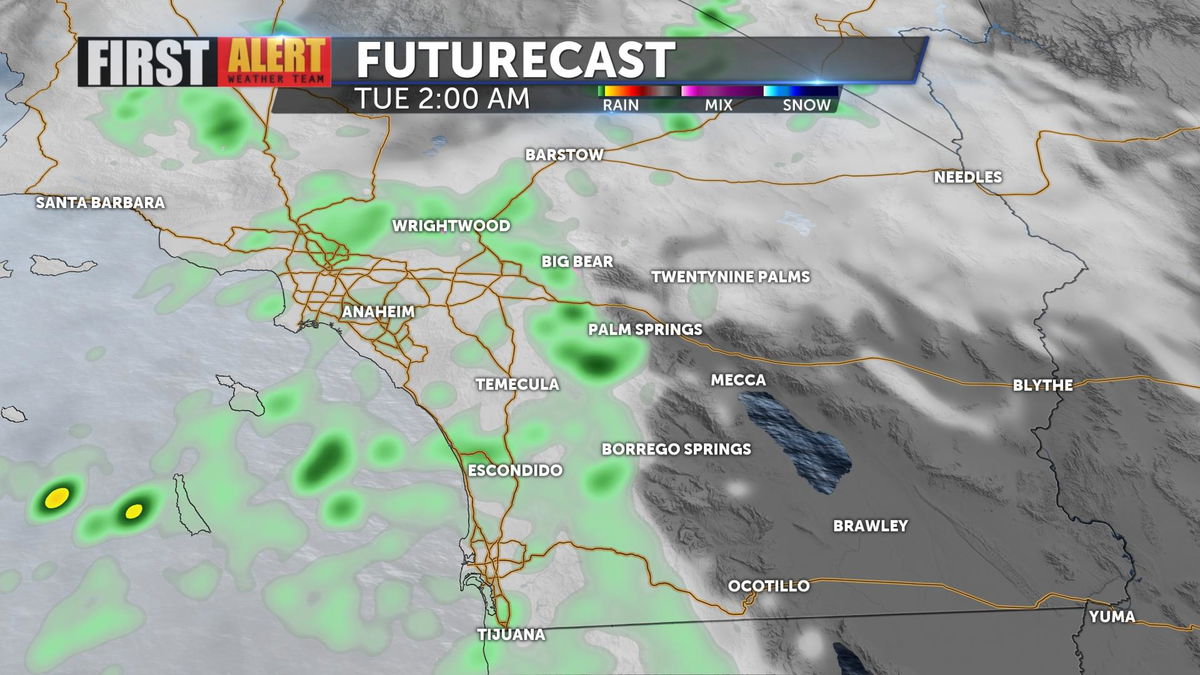
Rain has been seen on radar from the coast to the mountains throughout the afternoon. The desert has a chance for sprinkles and light showers through the night and into Tuesday morning.
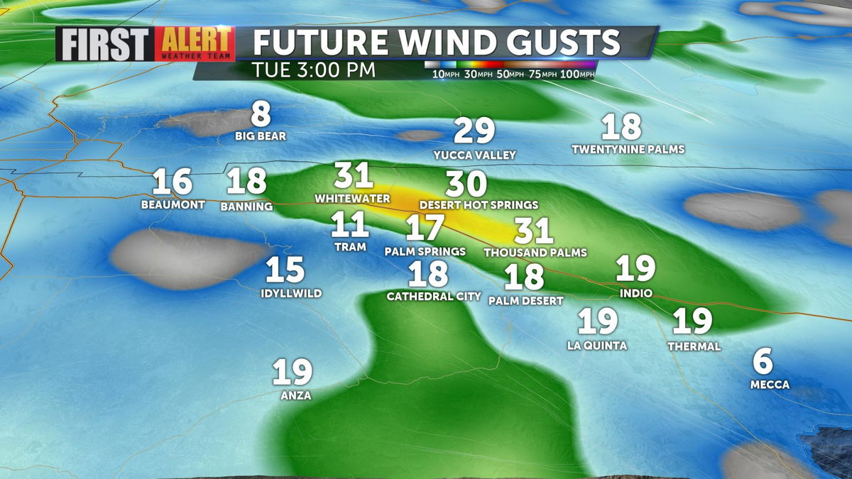
As the system moves east, winds around the desert will begin to strengthen. Gusts up to 30 MPH are possible for our wind-prone communities Tuesday afternoon.
Looking ahead to the weekend, more wind is expected on Saturday, this time out of the northeast.
Have you downloaded the 'KESQ First Alert' app yet? It's FREE! Click here.

You'll stay up-to-date with the latest weather videos. In addition, be able to monitor the changing conditions from wherever you are!
