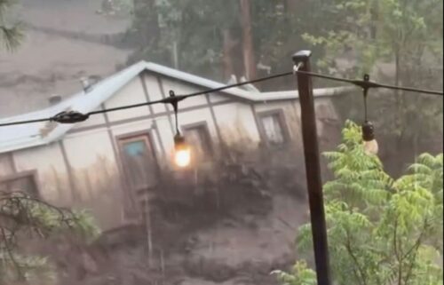
Winter storm set to cause more downed trees, power outages, and flooding for California
By Madison Richardson, Allison Chinchar, and Monica Garrett, CNN Meteorologists
A powerful winter storm system will strengthen over the Pacific, bringing damaging winds, rain, and heavy mountain snow to an already soaked California beginning Monday night.
“Preceding storms have saturated soils which will result in trees coming down and the potential for more power outages,” National Weather Service San Francisco meteorologist Roger Grass told CNN.
In an average winter, this type of atmospheric river storm would bring beneficial precipitation to the region. But given the unprecedented amount of rain and snow California has already received this winter, the storm will only exacerbate flooding issues, bring down weakened trees and add more snow to already record levels.
Much of northern California is forecast to pick up 1-2 inches of rain, including the Bay Area, with isolated areas of higher rainfall.
Though the totals may not seem very high, many locations are already experiencing their top 10 wettest Marches on record.
“We still have road closures in the mountainous areas because of the sheer number of landslide and rockslides since we have been impacted by so many storm systems,” Grass said.
More than eight million people along the central California coast are under a slight, Level 2 of 4, risk of excessive rainfall on Tuesday, renewing the threat of flash flooding.
The heaviest precipitation is expected to spread across the state Tuesday with steady rain in the valleys and coastal communities.
Cities like Oakland, Monterey, and Big Sur are on track to hit their top three wettest Marches on record by the end of this week.
The impacts of this storm are further complicated by strong winds.
“Saturated soils plus winds makes it even easier for downed trees and power outages to occur,” the San Francisco weather service said.
More than 15 million people are under a wind advisory in California and Oregon with gusts expected between 45 and 55 mph on Tuesday.
Because of the strong winds, near whiteout conditions are possible in parts of northern California near Mt. Shasta where 1 to 3 feet of snow could fall. Winter storm warnings are already in effect for this region and other parts of California through Wednesday.
The Sacramento weather service office calls for “major mountain travel impacts” in parts of northern and central California. Up to 4 feet of snow and wind gusts up to 60 mph are possible over the Sierra Nevada, leading to difficult travel conditions.
Statewide, the snowpack in California for the Sierras is currently at 228% of its normal amount for this time of year and this storm will only increase that margin. The Southern Sierras specifically have reached record levels, while the Central Sierra likely will by the end of the winter season.
The-CNN-Wire
™ & © 2023 Cable News Network, Inc., a Warner Bros. Discovery Company. All rights reserved.

