First Alert Weather Team explains how conditions led Hilary to wreak havoc across the Coachella Valley
The aftermath of Tropical Storm Hilary. One of the big questions, why did we see some of the biggest impacts here in the Coachella Valley compared to other parts of Southern California?
First Alert Meteorologists Haley Clawson and Patrick Evans explain how conditions in the Coachella Valley were the perfect recipe for the storm to wreak havoc across our valley.
Hurricanes are not a common part of the forecast for the Desert Southwest, but in August 2023, Southern California was focused on Hilary.
Going Back In Time
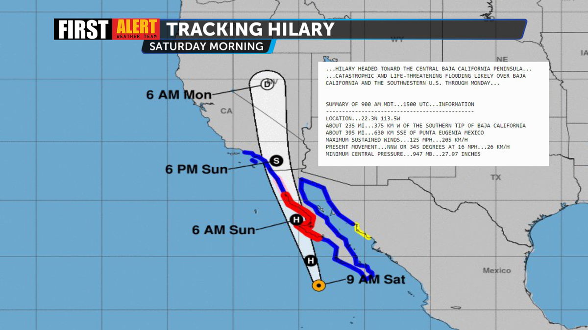
Once a category 4 hurricane, Hilary had dropped to a category 3 storm with maximum sustained winds of 125 MPH by Saturday morning, August 19th.
The morning of Sunday, August 20th, it had weakened to a tropical storm shortly before making landfall over the Northern Baja California Peninsula. At this point, the Coachella Valley had already received more than 0.30" of rain. The bulk of it fell Sunday afternoon. By the end, more than 3.5" had fallen across the desert. In the mountains of San Bernardino County, rainfall totals exceeding five inches produced runoff that contributed to the flooding in the Coachella Valley.
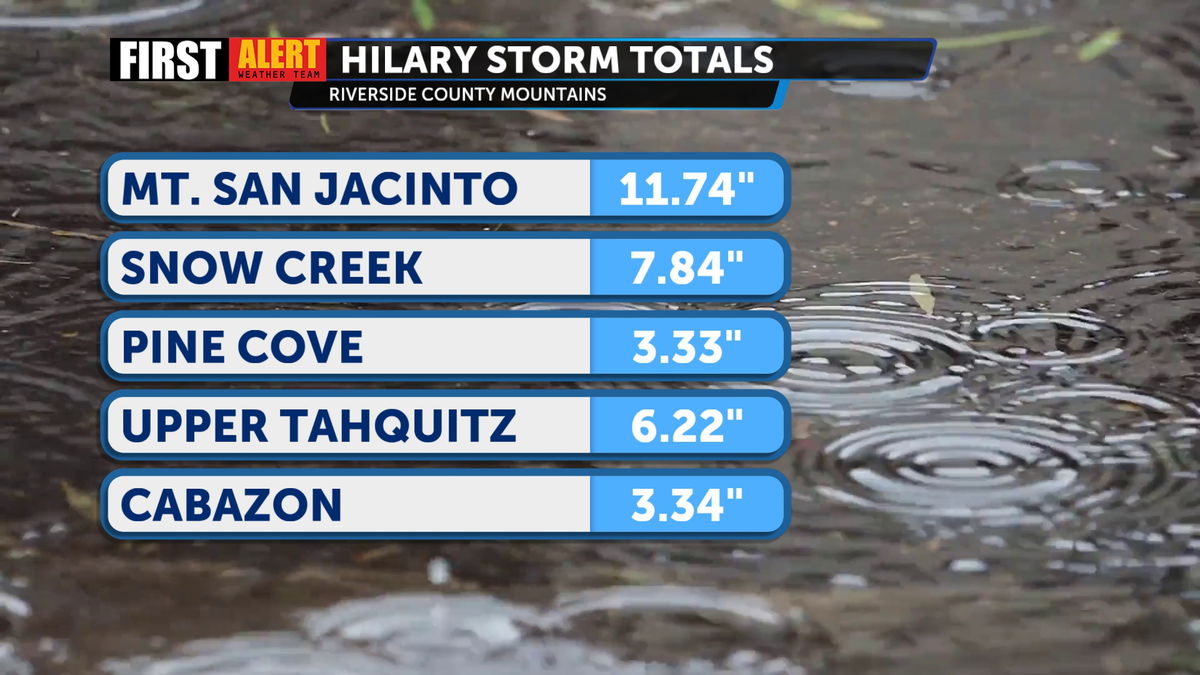

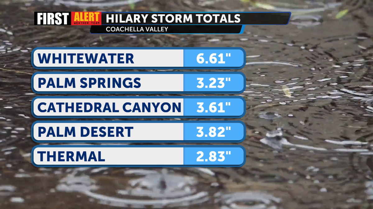
The mountains and desert communities felt the impact of Hilary more than many other parts of Southern California. There are two reasons for that: the terrain and hurricane anatomy.
The strongest part of a hurricane is the right side due to steering currents combined with the wind gusts within the system itself. This side of the storm typically generates a greater storm surge and is where tornadoes are more likely to form. As the storm bands moved counter-clockwise across Eastern Riverside and San Bernardino counties, the mountains acted like a wall, forcing more rain to fall on the east side of the mountains than the west.
Why Southern California Waters Are Not Ideal For Hurricanes
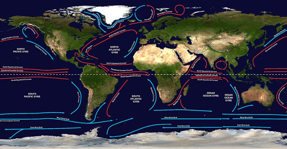
Ocean temperatures in Southern California are not favorable for tropical systems as the North Pacific Gyre brings colder water from Alaska down the West Coast.
The average temperature during hurricane season at Scripps Pier in La Jolla is in the 60s. Meanwhile, along the coast of Southern Mexico, the waters frequently exceed 80°. As a result of the cooler water, any systems that move north towards San Diego County lose their source of energy.
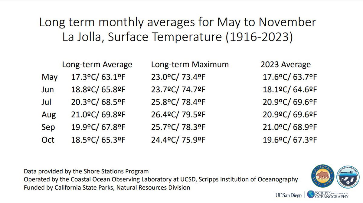
While Southern California waters still do not entice tropical systems to strengthen, there has been a distinct change in sea-surface temperature relative to the average temperature calculated from 1916 to 2023. Bottom line: the ocean is warming.

