Palm Springs adopts map for new district boundaries

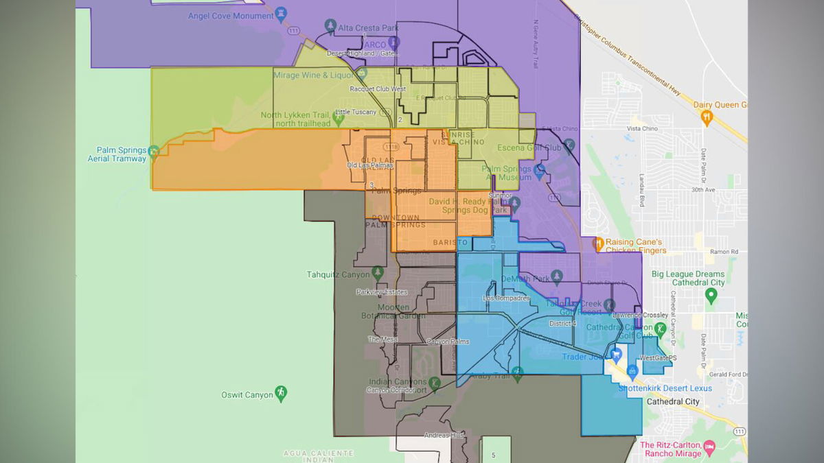
Palm Springs has a new map for its future district-based elections, and not much will change in the future.
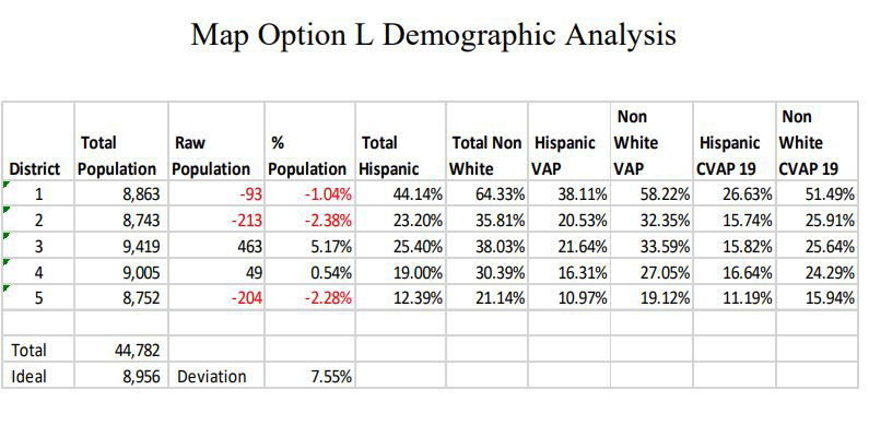
The city council unanimously voted to adopt Map L on Thursday.

Map Option L moves the commercial area in the Old Las Palmas neighborhood from Alejo Road, east of N. Palm Canyon Drive, and W. Tahquitz Canyon Way from District 5 to District 3.
"One of our sort of four priorities was to, an extent we could, keep neighborhoods together," said Palm Springs Councilmember Geoff Kors.
Districts 3 & 4 will see population gains with the change. Approximately 80 people will move election cycles, however, this group of people will move into an earlier election cycle.

Check out an interactive version of Map L below (Make Sure to Select Map L on Top Left):
Be the first to know when news breaks in Coachella Valley. Download the News Channel 3 app here.
