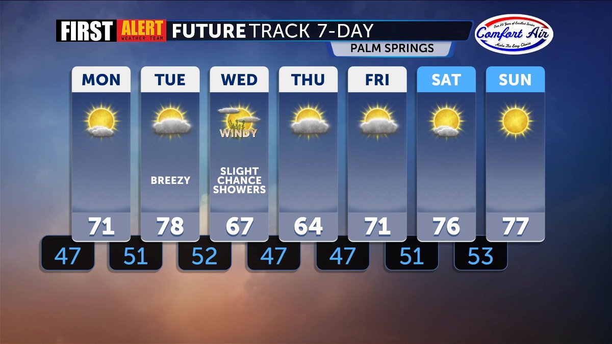
Breezy, quiet conditions before next storm system
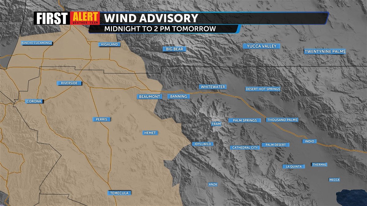
Winds remain breezy locally, but a Wind Advisory goes into effect tonight at midnight until 2 p.m. Monday afternoon for areas farther to the west. Here at home, we will feel a shift in winds Monday with an offshore flow, switching back to onshore by Tuesday. Wind speeds will gust as high as 25 mph for most valley cities.
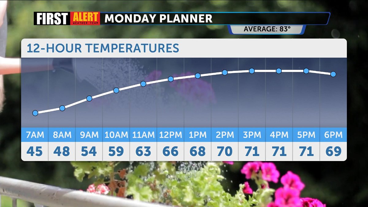
Monday temperatures stay consistent with the weekend, topping out in the low 70s for daytime highs and staying well below the average. Mostly sunny skies are expected overhead.
Looking ahead, temperatures make it to the upper 70s by Tuesday, but quickly dip with the arrival of low pressure. Showers are possible Wednesday, but overall rainfall accumulation appears limited. Expect gusty winds and additional mountain snow, with snow levels dropping around 5000 ft. Cool temperatures linger into Thursday with a warmer weekend to follow.