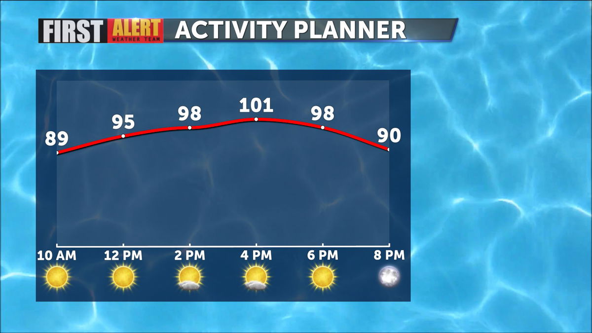
Triple digits poised to return today
Once again high pressure will stave off cloud cover and push highs into triple digit range.
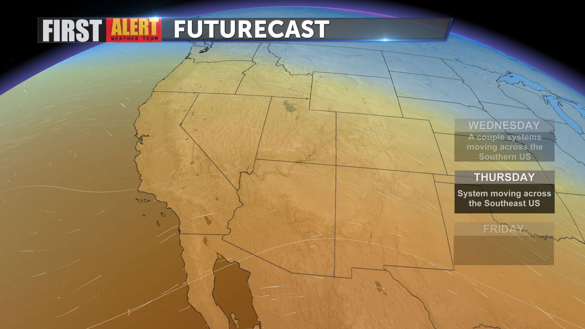
Heat over all of the Western US will remain in place through Friday, with some relief arriving over the weekend.
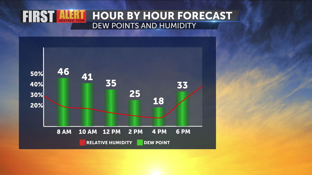
Dew points have been hovering in the upper 40s, particularly early in the day, but evaporative (swamp) coolers should still be an effective tool in fighting the heat, and today those numbers are expected to drop nicely in the afternoon.
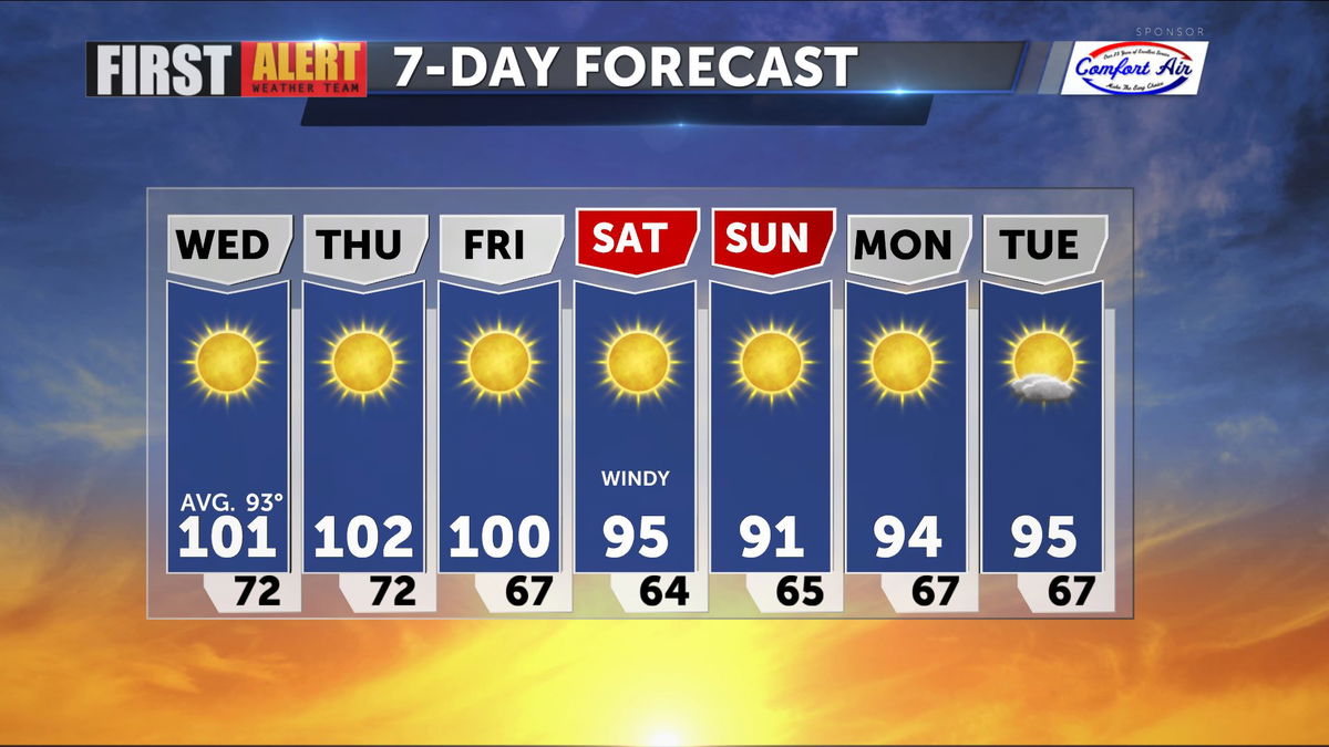
Highs will stay at or above 100 for the next 3 days, but windy conditions will drop highs in the lower and middle 90s moving through the weekend. Winds back off Sunday, and highs hover near 95.
We invite you download the KESQ First Alert Weather app, available on Apple or Android, and stay up to date with the First Alert Weather team and all the late breaking forecast changes! Click below.