Elevated fire weather conditions persist through week
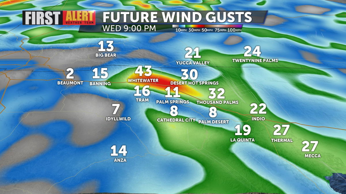
Breezy to gusty northwest winds can be expected around the mountains and desert this evening. Gusts will average 20-25 MPH around the valley floor, though strengthen in speed closer to the San Gorgonio Pass.
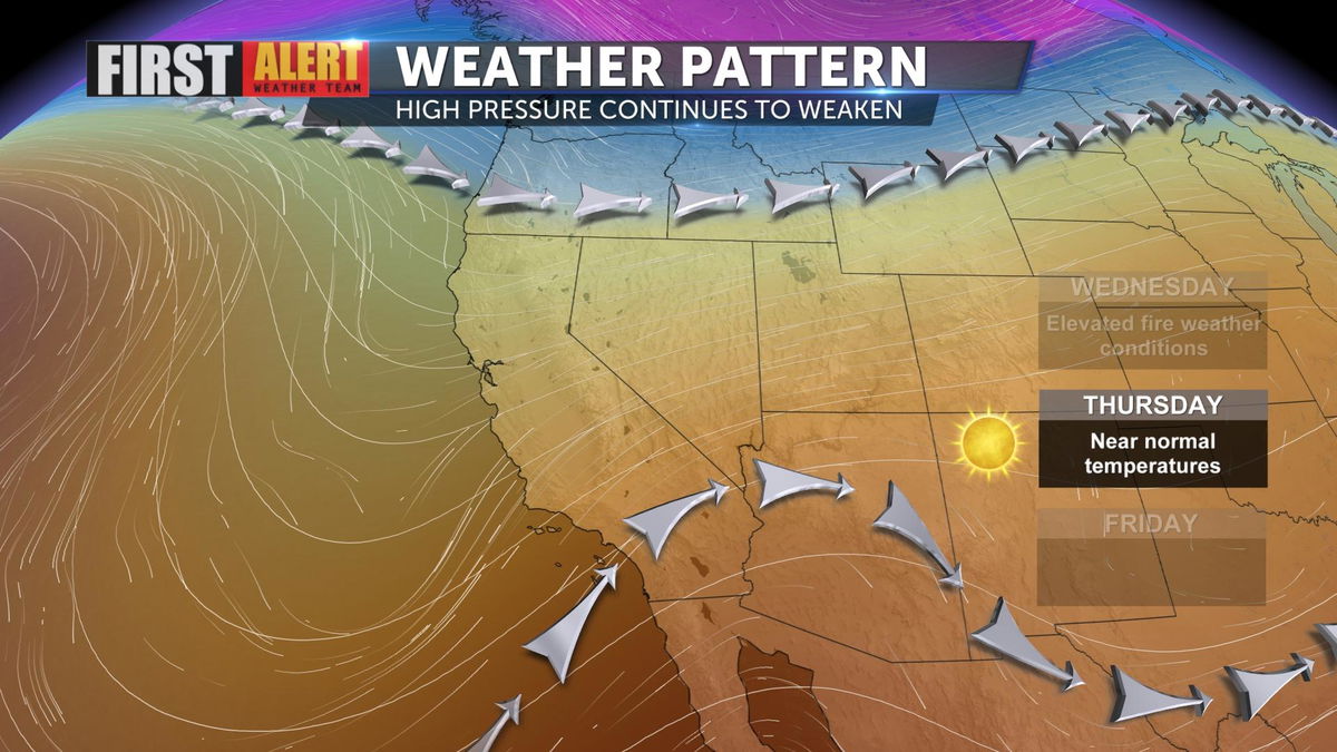
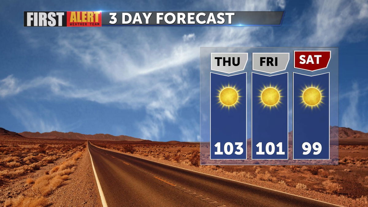
The ridge of high pressure that's been in place over Southern California continues to weaken. This will allow temperatures to steadily cool into the weekend ahead.
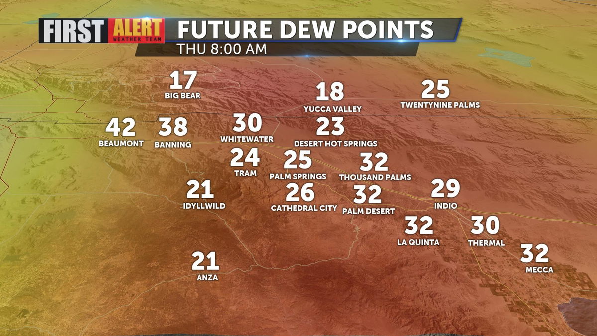
Dew point temperatures will remain low, in the 20s and 30s, through the remainder of the week. Great news for all of those who rely on evaporative coolers to beat the heat!
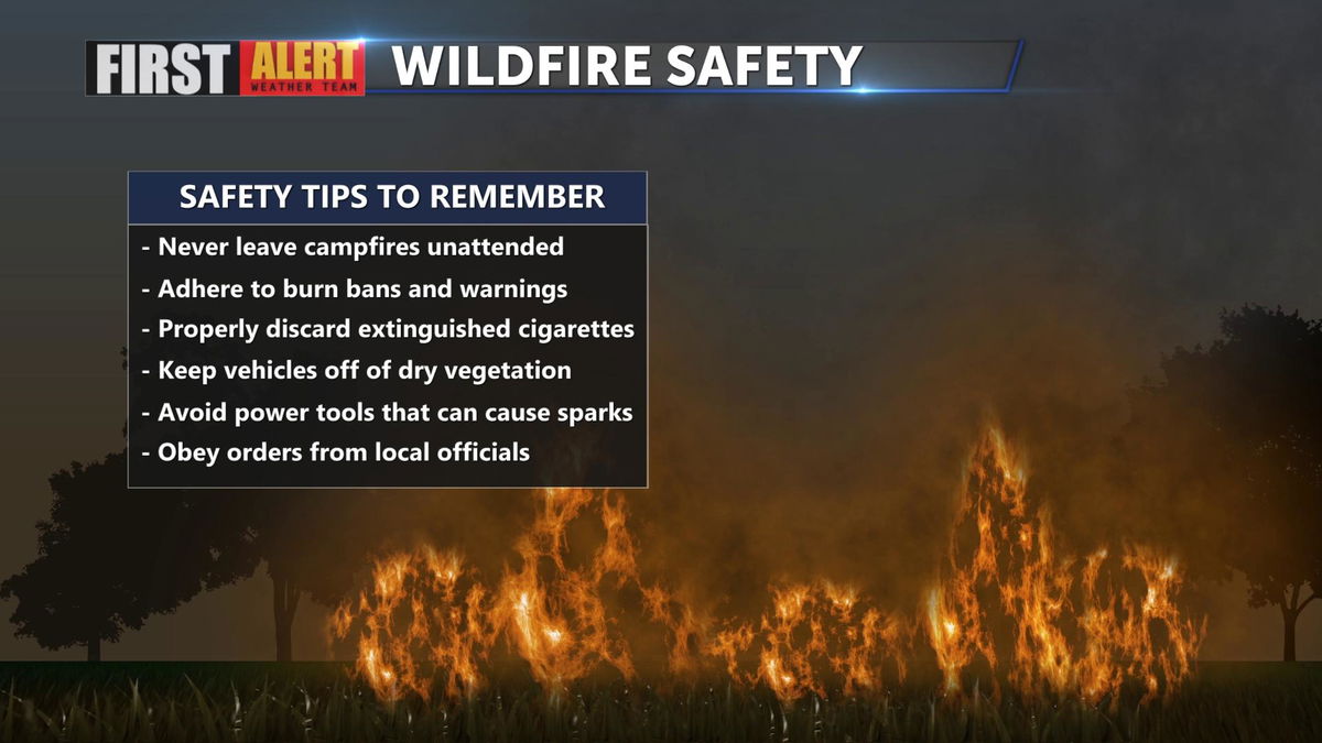
The combination of warm temperatures, breezy wind, and low humidity are elevating fire weather conditions across the Southland. Here are a few wildfire safety tips to keep in mind:
High temperatures will cool near the seasonal average on Thursday. Continued cooling into the double digits is expected this weekend.
Have you downloaded the 'KESQ First Alert' app yet? It's FREE! Click here.

You'll stay up-to-date with the latest weather videos. In addition, be able to monitor the changing conditions from wherever you are!


