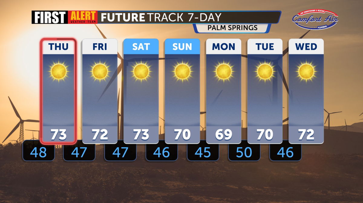
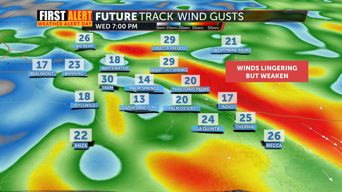
Santa Ana winds weaken overnight. Return to SoCal Thursday night into Friday continuing our extreme fire weather
We remain under a First Alert Weather Alert due to ongoing critical fire weather conditions and dangerous Santa Ana winds around Southern California.
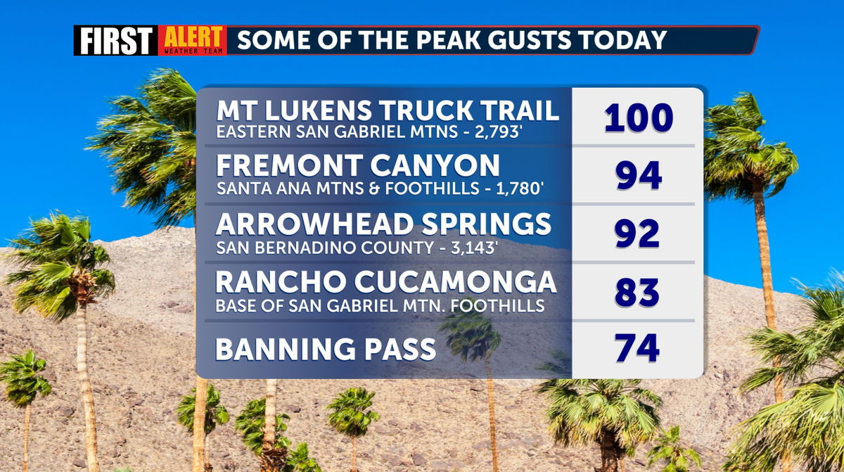
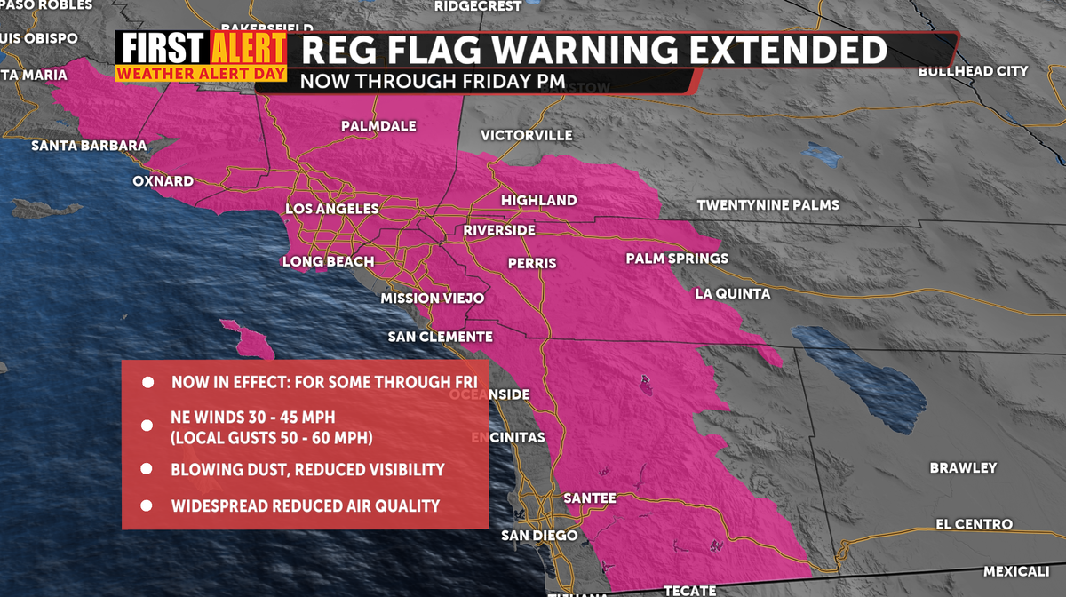
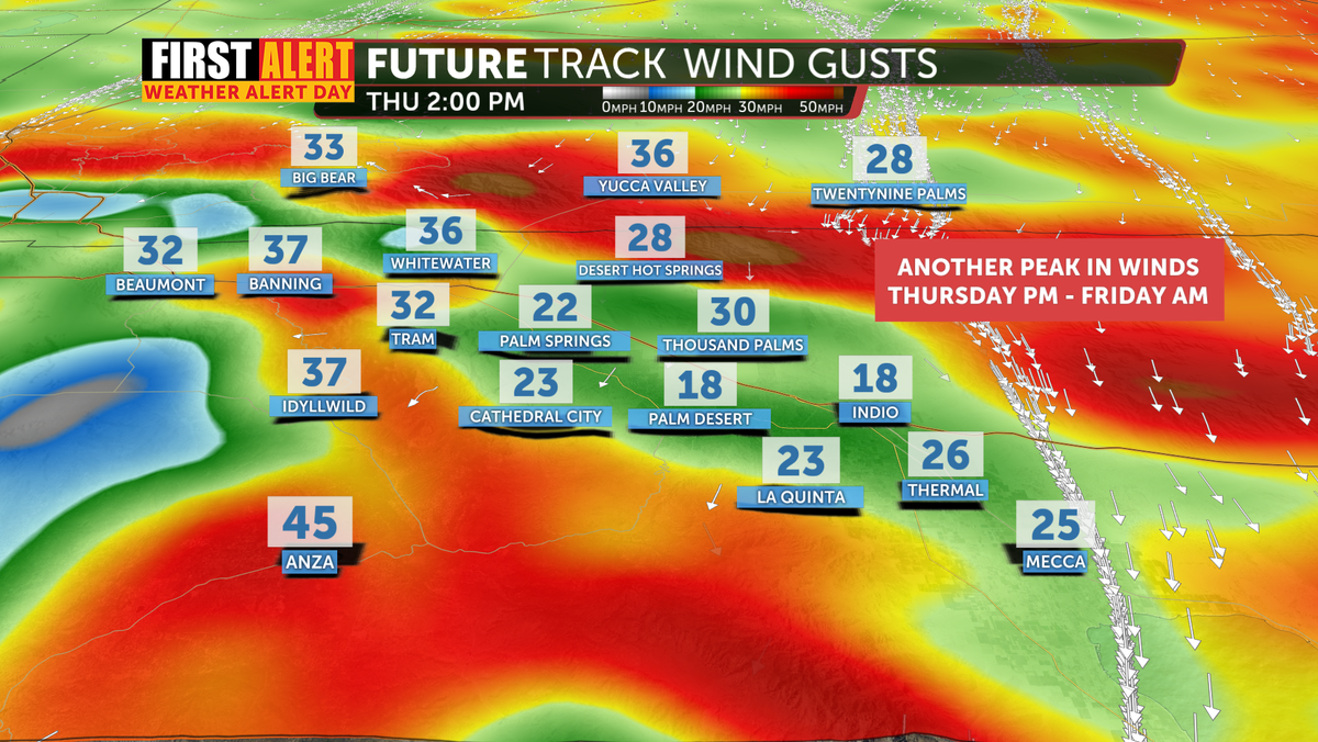
Red Flag Warnings have been extended and are in effect for some through Friday morning, with gusty northeast winds continuing to push dry air into the region. While we’ve likely seen the strongest winds, our peak winds the next few days are expected to develop late this afternoon into Thursday night, with gusts reaching 40 to 60 mph in mountain and foothill areas, and potentially as high as 75 mph in localized spots.
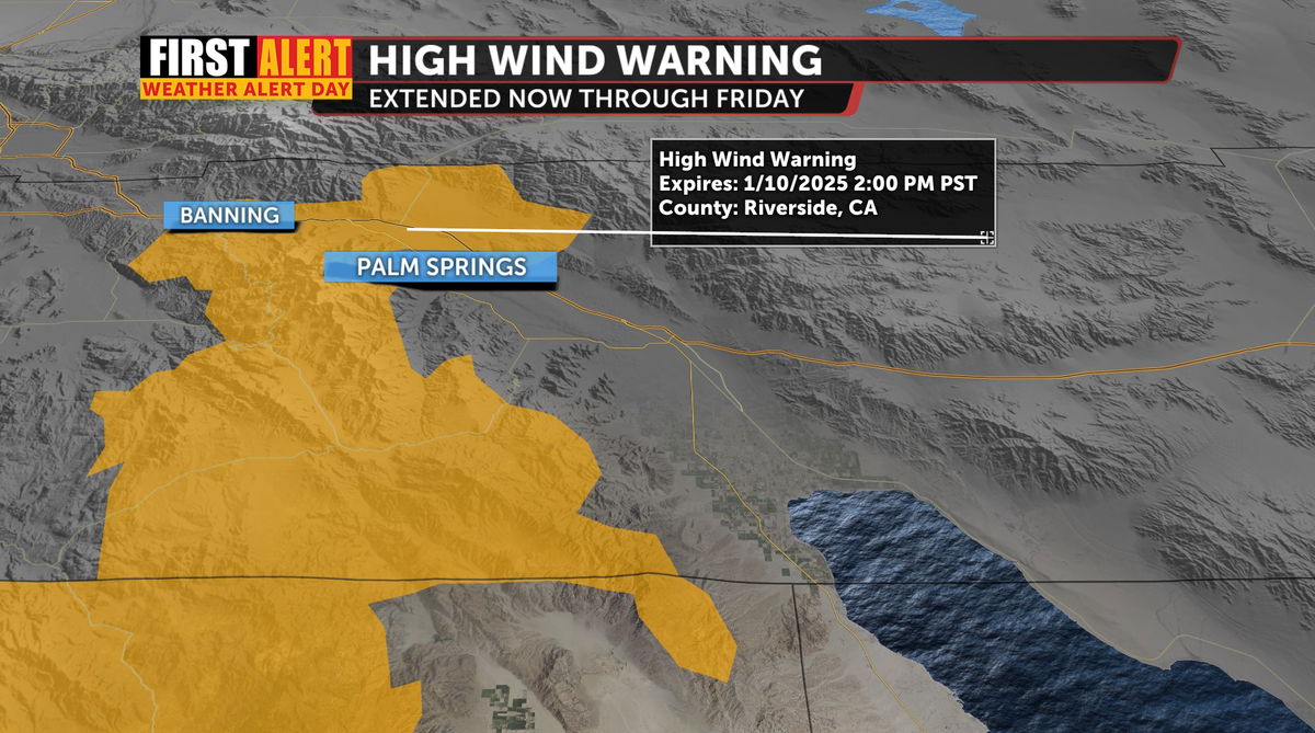
Thankfully some of our High Wind Warning was allowed to expire, but was extended for others--including Banning, San Gorgonio Pass, Cabazon, Whitewater, Desert Hot Springs, and North Palm Springs.
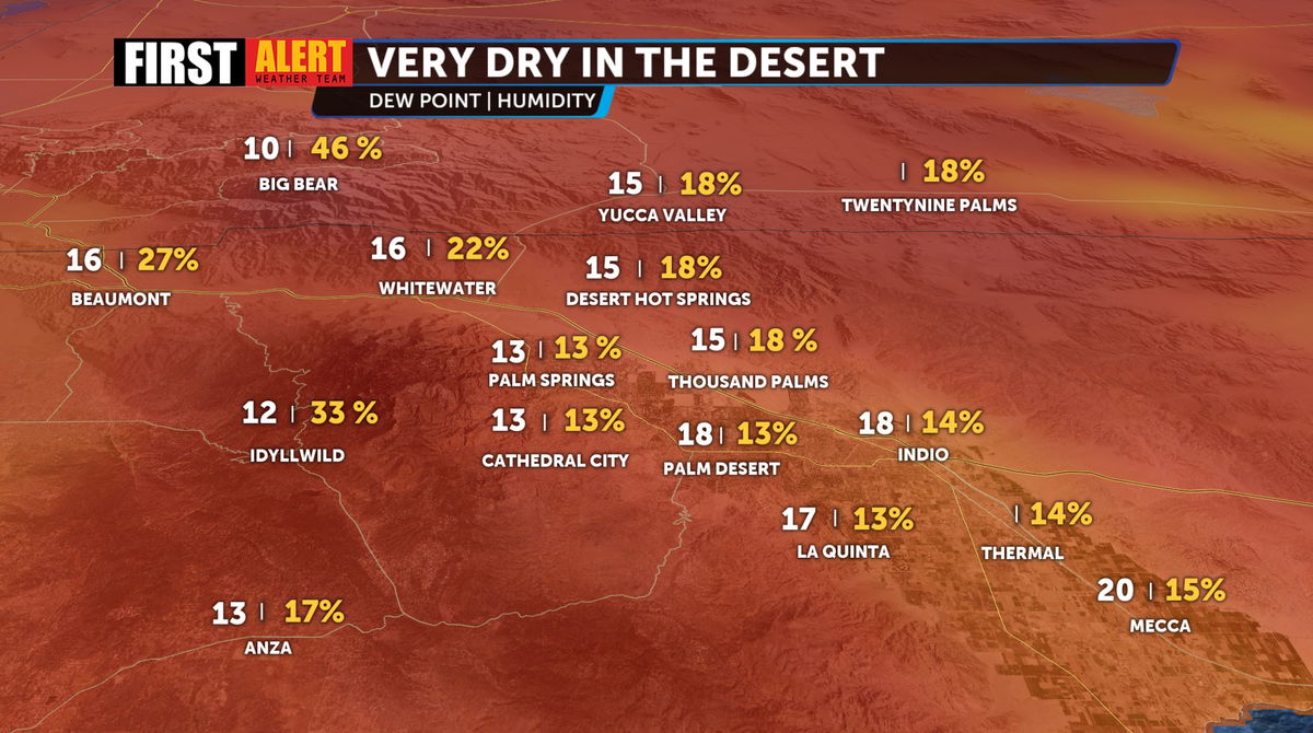
These powerful winds, combined with extremely low humidity, will create dangerous fire conditions, especially in the valleys and surrounding foothills.
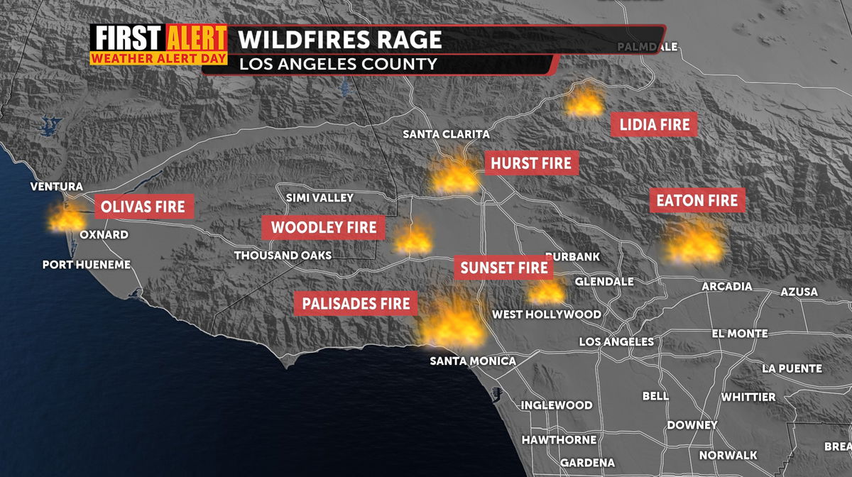
Since yesterday we’ve been watching numerous wildfires that fire crews are battling in Los Angeles County: The Eaton Fire, north of Pasadena, the Hurst Fire near Sylmar, and the destructive Palisades Fire, in the coastal neighborhood in L. A., along with numerous other smaller fires.
Temperatures are cooler, but remaining quite mild today, more widespread cooling is expected Thursday and Friday as a weak trough of low pressure passes by to the east.

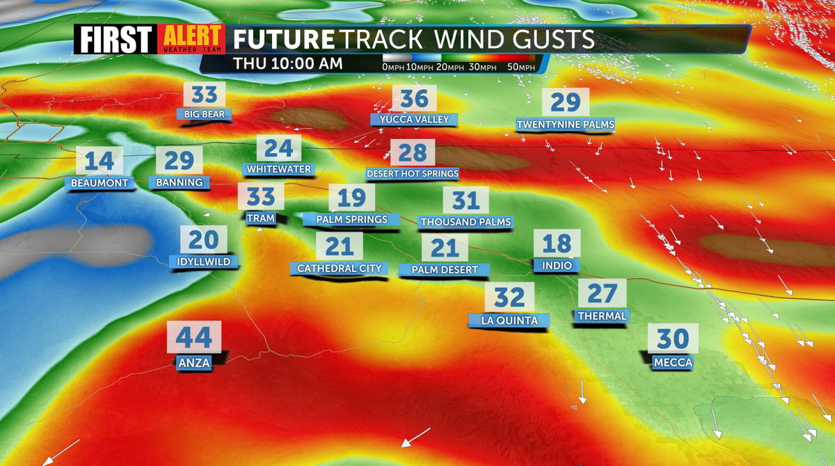
We’ll see a brief decrease in wind intensity overnight and Thursday morning with more gusts arriving late Thursday and Friday morning.
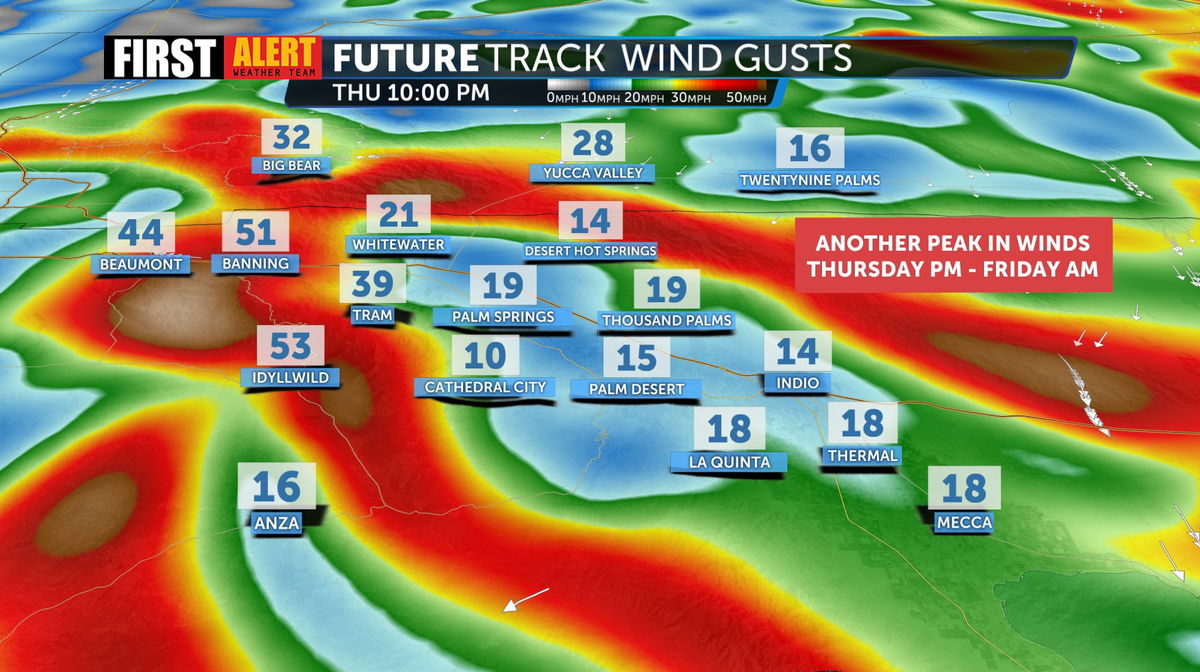
We return to calmer winds Saturday, but our fire danger will stay elevated, especially in areas prone to Santa Ana wind exposure.
Fire Conditions the Next Few Hours:
Overnight humidity will remains very low, dropping to as little as 8-15% in the valley, exacerbating fire risks. Critical fire weather is expected to linger into Friday, with little relief overnight. Avoid outdoor burning, as our threat of rapid fire growth/spread is high.
Cooler, breezier conditions will return early next week, with a slight chance of another wind event later in the week.
