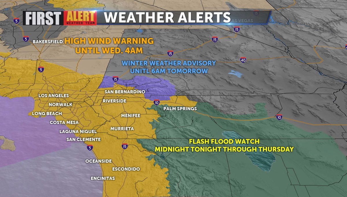
High Wind Warning in effect; Flash Flood Watch starts at midnight
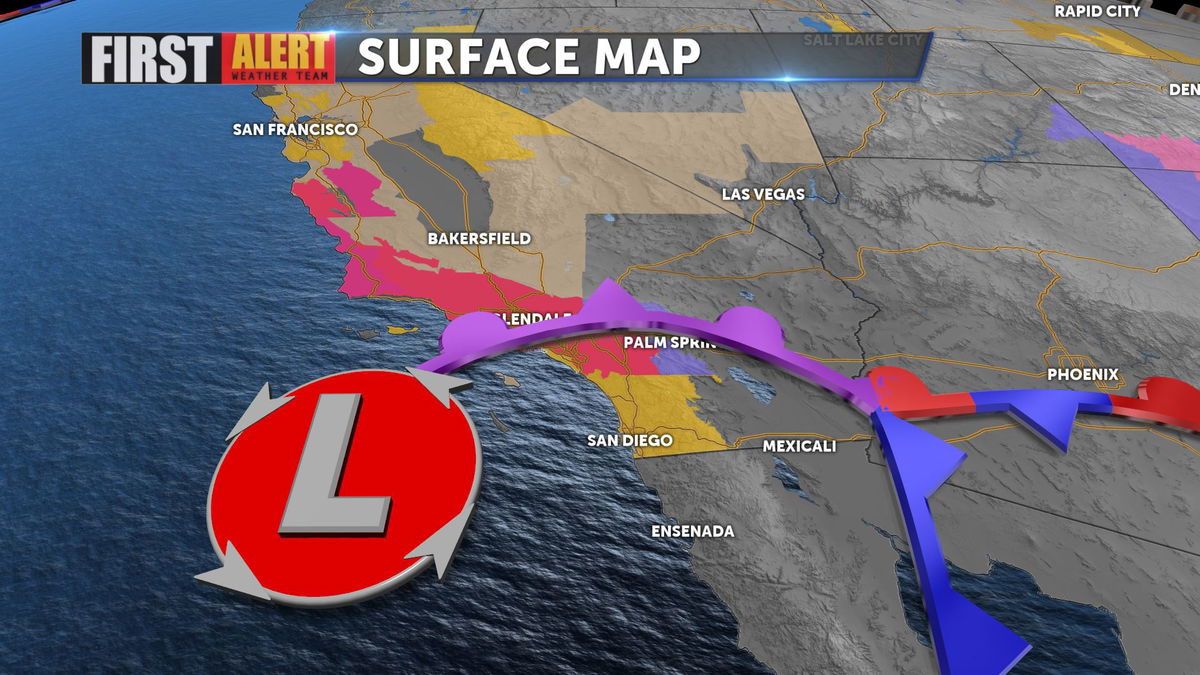
High Wind Warnings are up, stretching from Desert Hot Springs through the pass along the I-10 corridor all the way to the Coast as an area of low pressure develop over coastal Southern California. The low will also bring rain and snow to the mountains, with a Winter Weather Advisory posted above 5,500 feet.
There is also a Flash Flood Watch that will go into effect at midnight as periods of heavy showers will move through the region as an area of Low Pressure builds into SoCal. This will be accompanied by gusty winds and cooler temperatures.
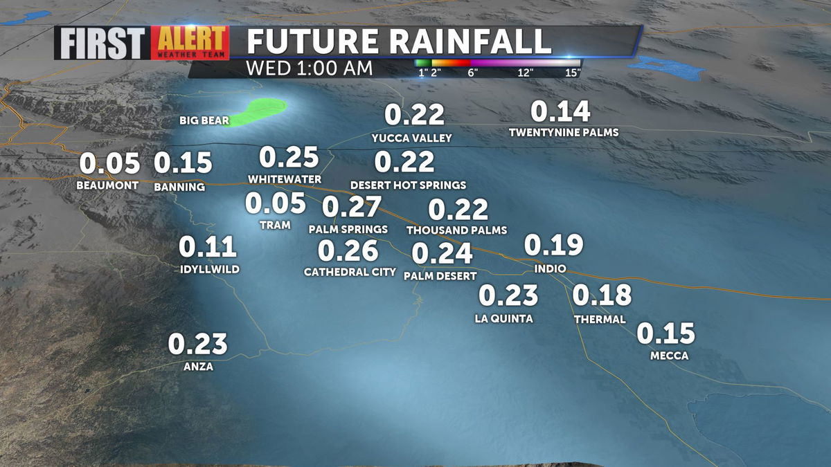
That area of low pressure is pulling moisture up from the South and will deliver some much need rain in the form of showers late this afternoon and evening in and around the Coachella Valley.
Most likely timing would see rain in the Valley in the late afternoon and early evening with sporadic showers ovenright.
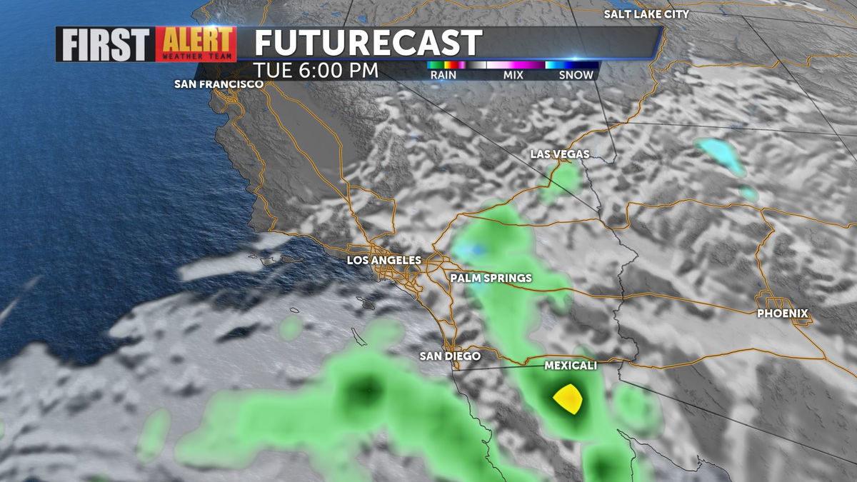
Rainfall totals could reach a quarter of an inch or more, as there are potentially some heavier imbedded showers within the rain shield around the low. Expect several inches of snow at the highest elevations in the mountains of San Bernardino and Riverside counties in addition to the rain.
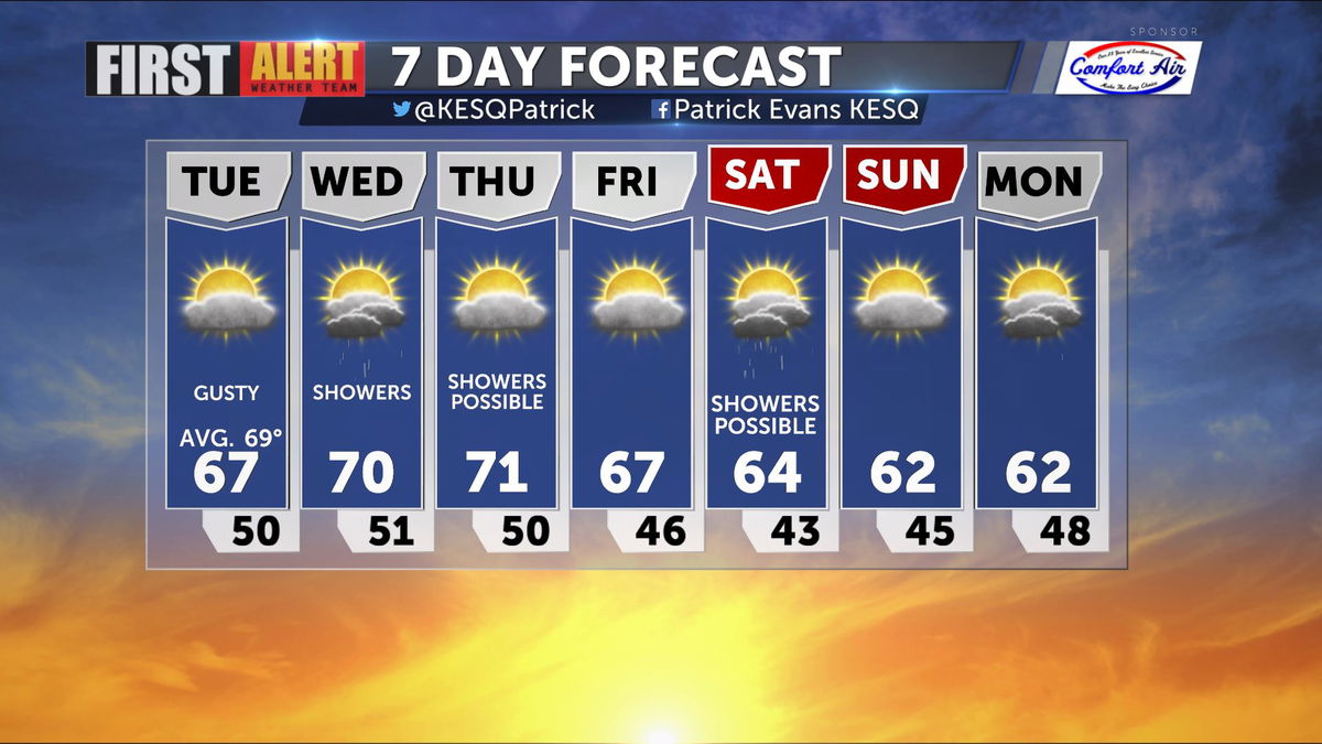
Highs will remain in the sixties to near 70 for a couple of days before another round of potential rain moves in by the weekend, dropping highs even lower.