Active weather for the end of the week
An active weather pattern has returned to the valley today due to the arrival of another storm system. Heavier cloud cover is here to stay today as a low-pressure system tapping into an atmospheric river continues to stream moisture into California. This storm system has weakened as it moves closer to the valley but you may want to anticipate some spotty showers.
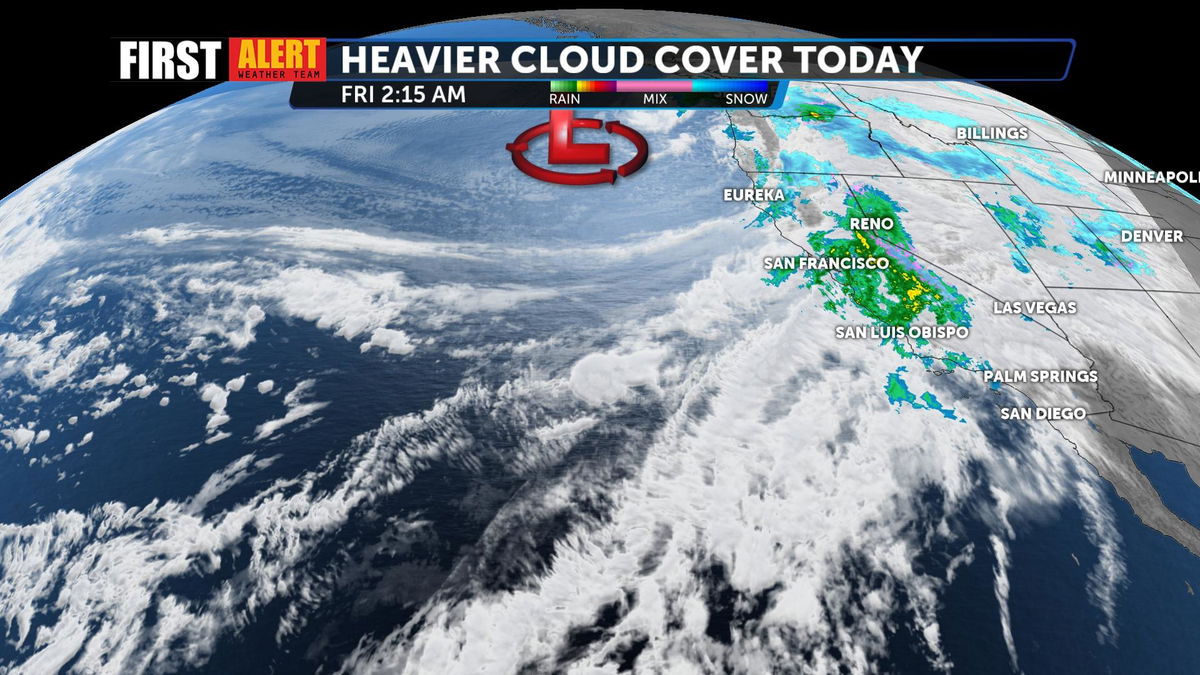
The bulk of the action will be reserved for the Inland Empires and our local mountains. Light showers could trickle onto the valley floor but impressive rainfall totals are not likely.
Here's a look at the storm system at 1 p.m. today:
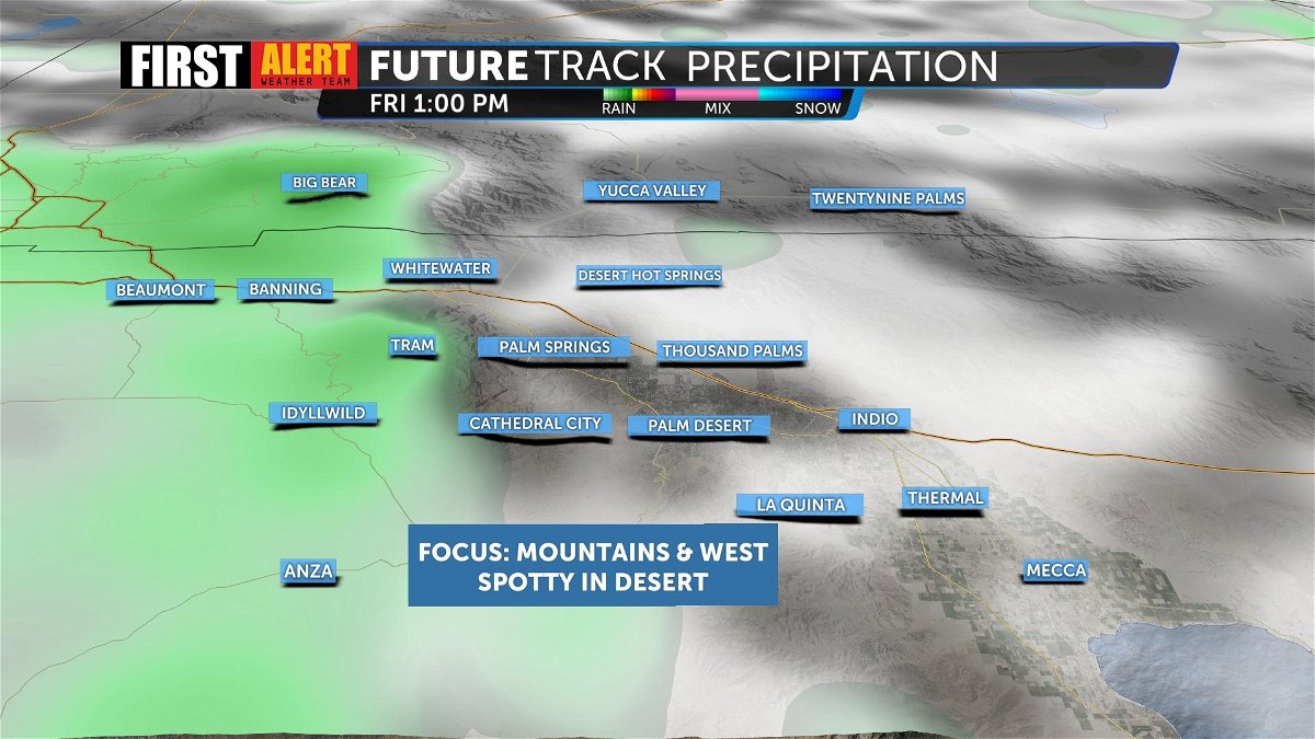
In anticipation of this warmer storm system that is set to bring more rain than snow, The First Alert Weather Team was tracking the possibility of flooding from mountain runoff. At this time, flooding does not seem likely due to the heavy snowpack but the rain may impact structures that are already being weighed down by snow in mountain communities.

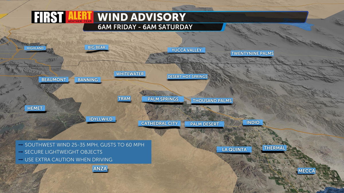
The main impact with this storm system will be stronger winds on the valley floor. A Wind Advisory will take effect this morning for San Bernardino County mountains, and Riverside County mountains later this evening. We could see wind gusts between 55-60 MPH in these areas.
Though an active weather pattern remains for Friday, our temperatures will remain in the 70s through this weekend. We'll briefly rise into the 80s at the beginning of next week before temperatures begin to drop back into the 70s as another storm system moves in.

Stay with News Channel 3 and The First Alert Weather Team for continuing updates.


