Mild conditions continue as active weather pattern approaches
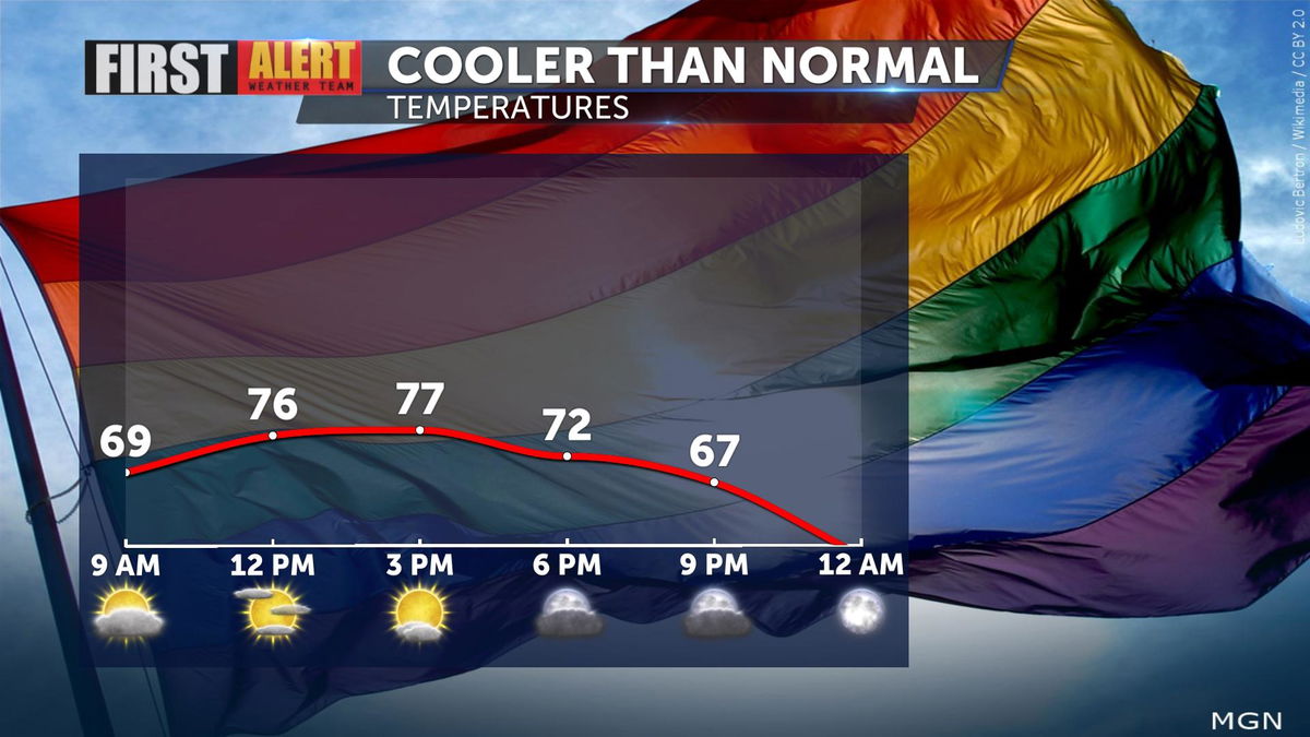
Conditions have remained calm and mild this weekend. Temperatures have warmed slightly as they hover in the mid to upper 70s which is about 5° below our seasonal average. Perfect weather to attend our local Pride events!
Big changes arrive by Monday as a Pacific storm system, including an atmospheric river, moves into Southern California. Increased moisture from the incoming atmospheric river will promote the development of widespread rain and even mountain snow!

Potential rainfall will remain light on Monday with heavier rainfall and mountain snow expected on Tuesday.

A Winter Storm Watch will go into effect on Monday and last through Wednesday afternoon. Mountain areas above 6,000 ft. could see up to a foot of snow and up to 2 feet for areas above 7,000 ft. during this period.

Due to these upcoming conditions, a First Alert Weather Alert has been issued for Monday, November 7th, through Tuesday, November 8th.
This Pacific storm system is expected to move farther east by Wednesday and will leave drier, clearer and cooler conditions in its wake as daytime highs dip into the 60s until next weekend.


