
Winds of Change: A look at the history of wind in Palm Springs
Chief Meteorologist Haley Clawson collected and organized years of data recorded at Palm Springs International Airport to answer the frequent viewer question, "Is it getting windier"?
Straight to the point... there doesn’t appear to be a long-term increase in the average wind speed. However, it's a different perspective in the short term, as the last four years have shown a steady rise in the average wind speed from 6.175 MPH to 6.833 MPH.
But what does it mean to be “windy”? The National Weather Service would describe it as a sustained wind of 20-30 MPH. Similarly, the United States Environmental Protection Agency considers a “high wind dust event” as sustained winds of 25+ MPH.
With that in mind, 2023 led the past decade with 86 days, reaching a maximum sustained wind of 25 MPH or greater, followed by 2016 with 78 days.
If the focus shifted to wind gusts of 40 MPH or greater, 2021 led with 24 days, followed by 2023 with 21 days.
Archiving and interpreting past wind data is something the National Weather Service office in San Diego has been looking into as well.
“We did see an increase in those sustained winds reaching 30 miles per hour and even those gusts getting around 40 miles per hour. Basically, you know the occurrence was more frequent than a 20-year average when we looked all the way back to 2004 to 2022,” shared Alex Tardy, Warning Coordination Meteorologist with the National Weather Service.
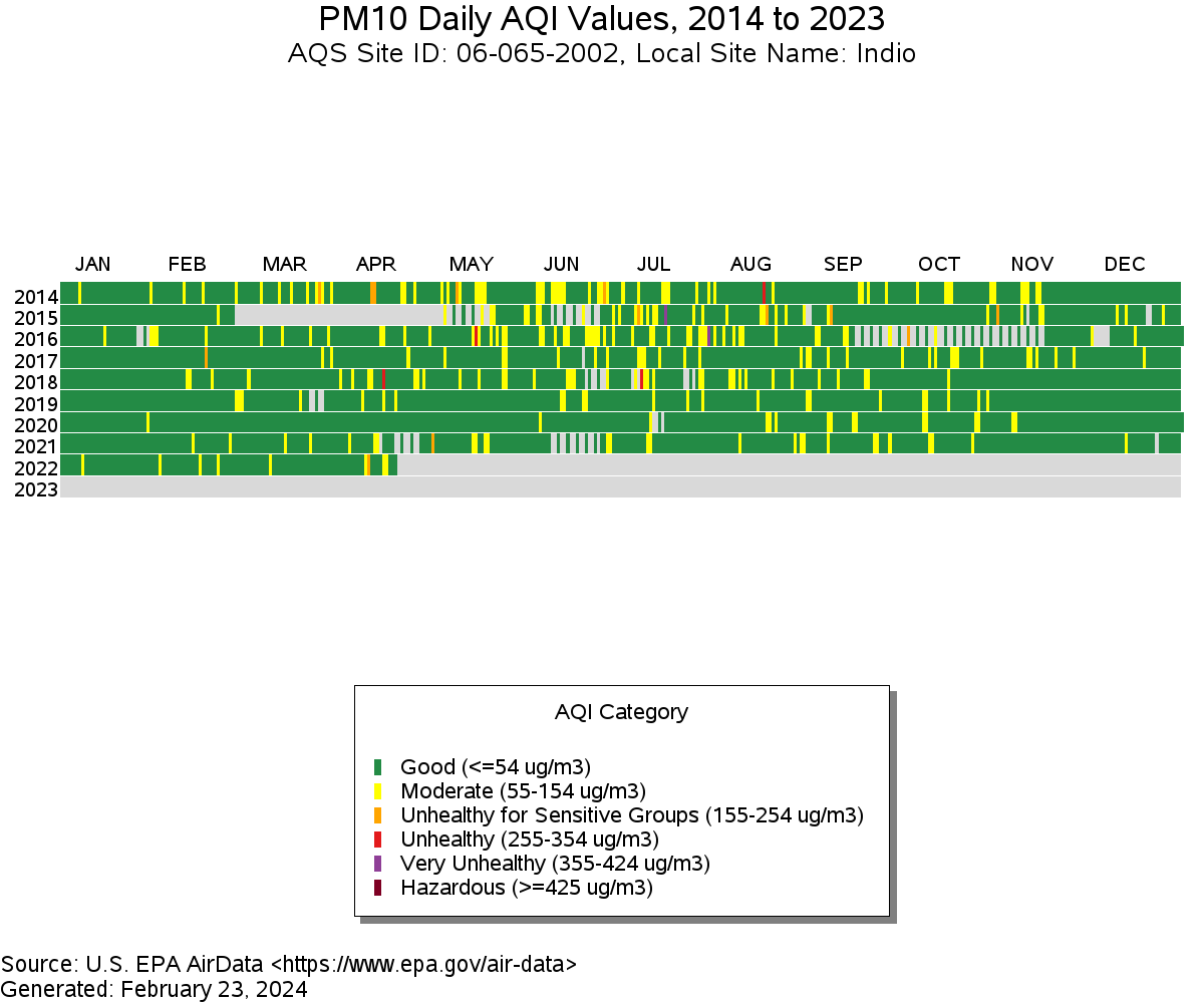
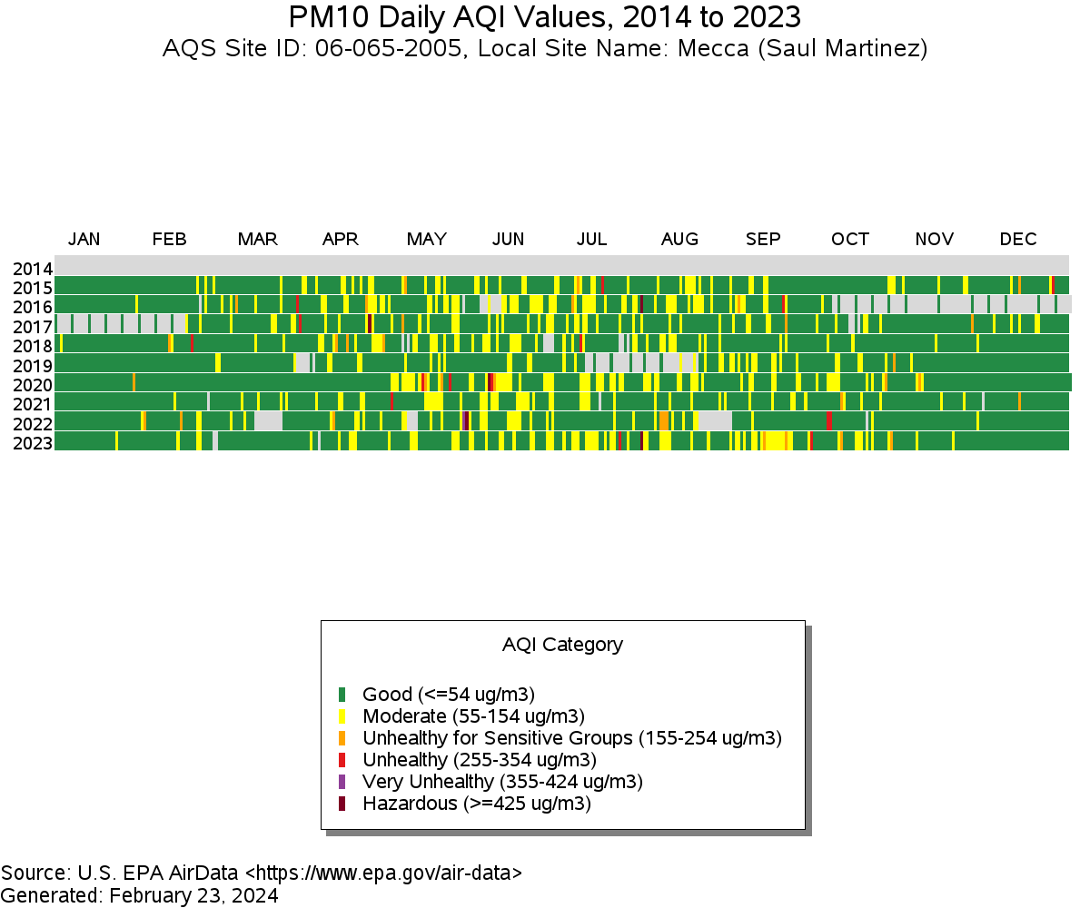
Another way to track the wind is by examining its impact on air quality. The Coachella Valley is no stranger to dusty days, especially following Tropical Storm Hilary, but how have they evolved over the past decade?
The EPA’s Air Quality System monitors the daily mean PM10 concentrations at three sites in the Coachella Valley. From a regulatory standpoint, the EPA is observing when the 24-hour average concentration of PM10 exceeds 150 micrograms.
“So based on those thresholds, the number of times PM10 exceeds the regulatory threshold varies each year with no obvious increase for the last 10 years”, said Sheila Tsai with the U.S. Environmental Protection Agency's Air and Radiation Division.


A broader look at the air quality history shows no apparent rise in reduced air quality as an overall trend.
Tsai continued, “Based on the regulatory data, there's no obvious uptick in AQI values for PM10 at the Indio, Mecca, and Palm Springs monitors"

The weather pattern evolves from one year to the next, but as temperatures warm with the changing climate, the jet stream is shifting north.
"The storm track is retreating further north. And that's putting us on the drier, windier side. That said, within that storm track, we also see evidence of stronger storms, less frequent, but stronger storms," explained Tardy.
The bottom line is the potential for more extreme events.
