Mild temperatures for the final days of summer
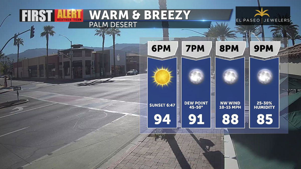
A warm and breezy start to this workweek, though afternoon temperatures have been fairly consistent for the past week. Clear skies and low humidity will stick with us through the night, creating a comfortable evening for your outdoor plans.
The trough of low pressure along the west coast is bringing wet weather to northern and central California. The Coachella Valley will remain dry and cooler than normal but will feel the stronger onshore flow through the middle of the week.
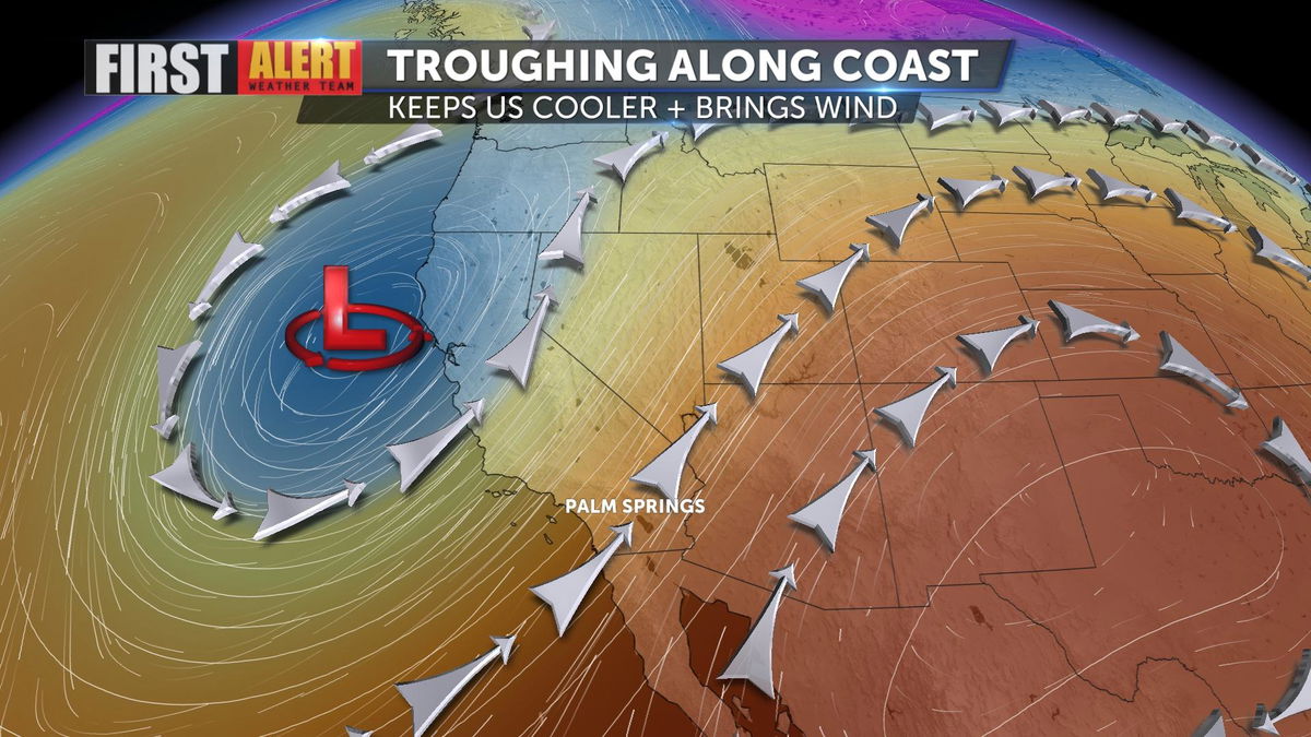
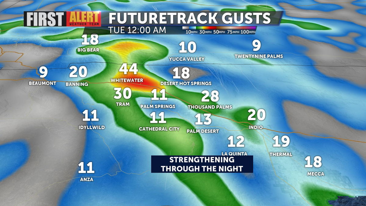
While not overly gusty, northwest winds will be felt through the low desert. The strongest gusts will be present through the San Gorgonio Pass, and communities along the interstate could reach up to 30 MPH.
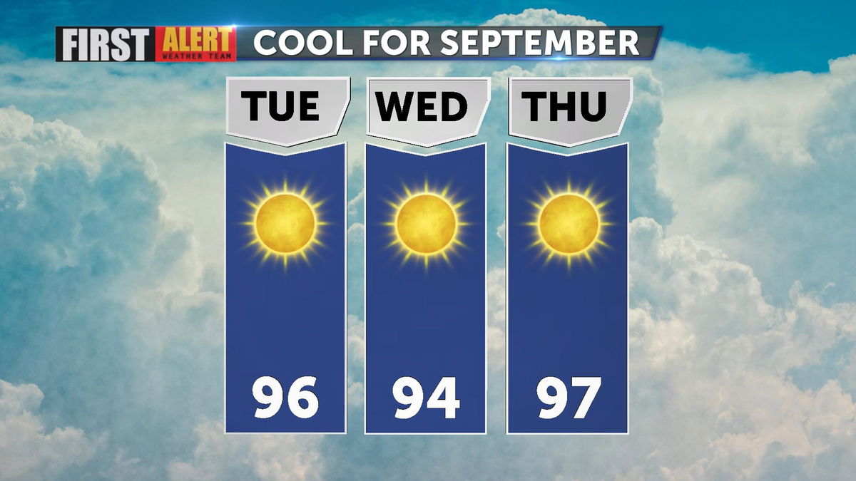
Just three days until the fall equinox! The cooler-than-normal temperatures we've been feeling will last through the final days of summer, but highs will return to the triple digits by the weekend.
Have you downloaded the 'KESQ First Alert' app yet? It's FREE! Click here.

You'll stay up-to-date with the latest weather videos. In addition, be able to monitor the changing conditions from wherever you are!