Trading Winds for Winter Weather this Weekend as Changes Bring New Threat for SoCal Wildfires
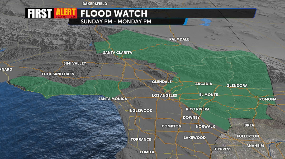
Finally a welcome wrap up to our Santa Ana winds as we transition to a wet system and winter weather, which brings a new slew of dangers and concerns for Southern California wildfires. The potential for significant rainfall over wildfire burn scars has triggered a Flood Watch.
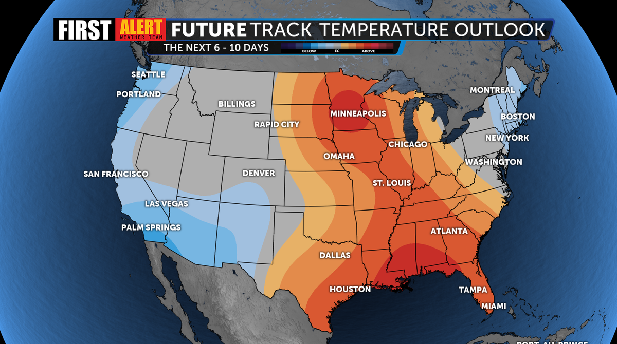
This incoming system also brings about a dramatic drop in temperatures with widespread cooler weather ahead Saturday through at least Tuesday of next week.
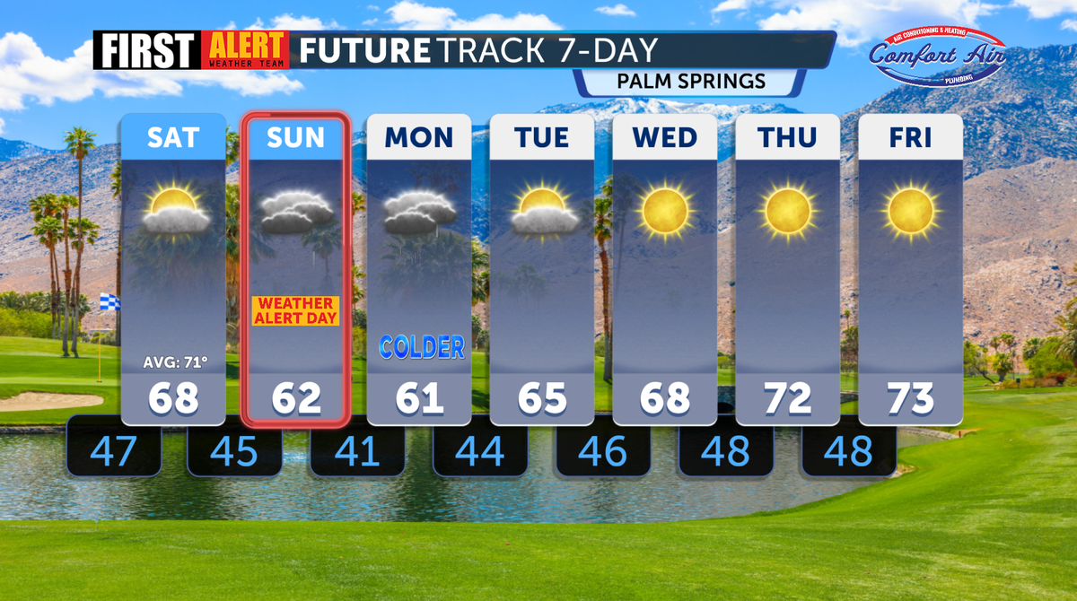
Because of this active wet weather, likelihood of snow in the mountains and potential impacts to weekend road conditions we've issued a First Alert Weather Alert for all day Sunday. Expect any outdoor plans to be impacted for the second half of the weekend.
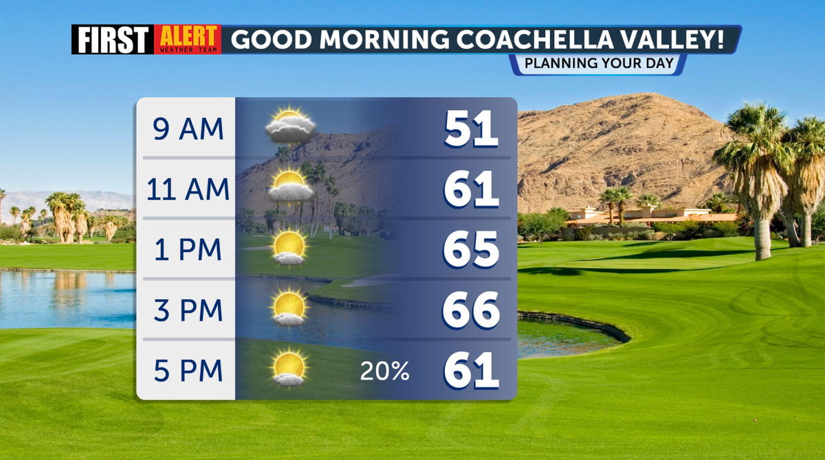
Today—I’ve been watching some subtropical moisture moving in, bringing some high cirrus clouds overhead across the region. I’m calling today our “transition day” before we enter into a much more active and wetter weather pattern. Across the Coachella Valley, nice and pleasant conditions for your Friday, but temperatures are beginning to drop from our warm past couple of days. The weekend starts nice and dry across the valley, but our rain chances start increasing overnight.
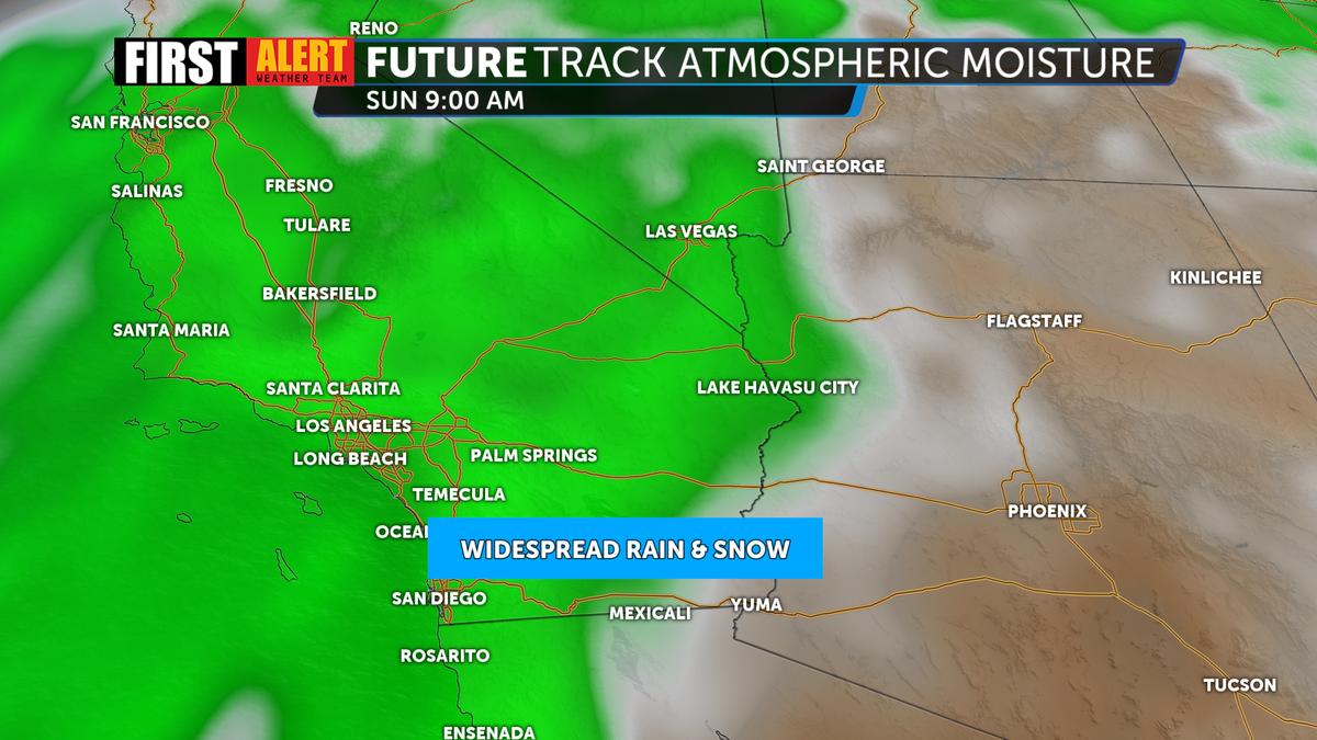
Next up: is a COLD low pressure system beginning to form across Northern California. As it drives south, this will tighten our pressure gradients bringing in some gusty southerly winds—strongest gusts up to 55mph possible in some localized areas—though this will not be widespread.
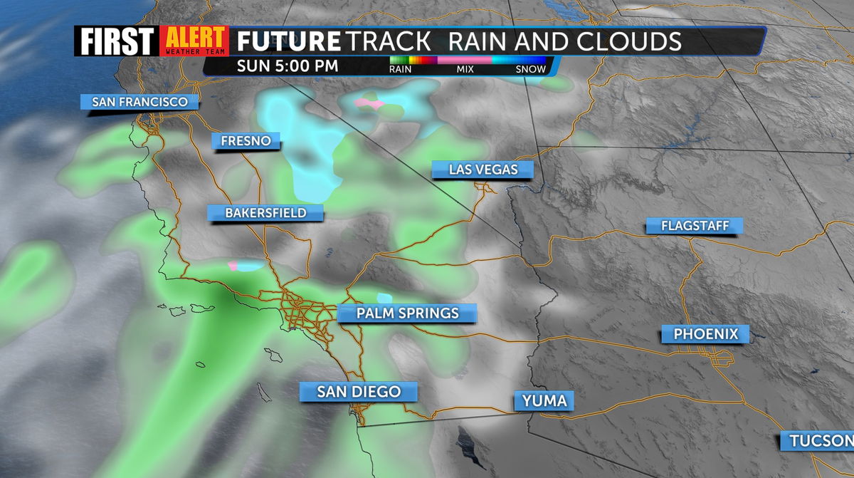
Our scattered showers arrive along the coast first beginning Saturday afternoon around Orange County and the Inland Empire. That slow moving system gradually pushes east into parts of Riverside and San Diego County overnight.

The speed in which it moves will greatly determine exact rainfall totals we could see. Around the desert we could see near a 1/4” of rain, with some spots—especially around the high desert and some of of westside foothill communities looking at closer to 1/2” of rain. I’m not ruling thunderstorms out Sunday night into Monday—but right now most models are showing pretty low confidence.
Big thing to emphasize here is that this is going to be a COLD system. Highs are expected to drop around SoCal 10-15 degrees below normal.
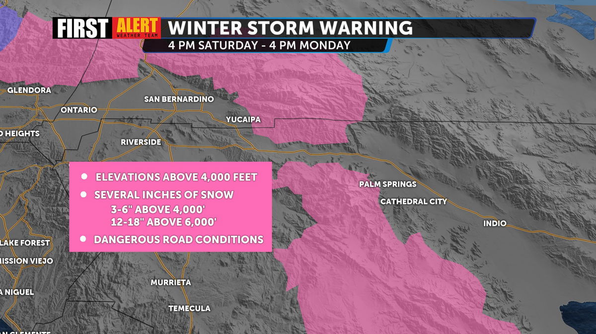
Winter Storm Warnings are in effect for Riverside and San Bernardino County mountains along with a Winter Weather Advisory for San Diego County mountains above 4,500 feet from late Saturday afternoon through Monday afternoon. We’ll likely see some moderate snowfall from this system as snow levels drop to near 3,500’ and even 3,000’ for northern areas. Bottom line: this WILL impact road conditions if you’re driving over passes or the mountains this weekend. Expect chains to be a requirement for some mountain passes.
As for snow totals: we could see 12-18” of snow over 6,000’. feet will see around. Lower amounts, 3-6: above 4,000 feet in the San Bernadino/Riverside Co mountains. We could even see some accumulation across high elevations of the high desert.
Weather begins to calm down later Tuesday. By mid next week look for drier and warmer weather to return beginning Wednesday.
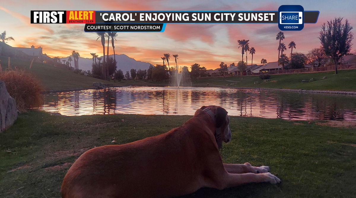
Our Coachella Valley viewers send the BEST sunset/weather photos--but this shot of 'Carol' the Mastif mut enjoying the sunset tonight in Sun City Palm Desert is too good not to share. Remember you can share your weather photos with share@kesq.com.