Cooler temperatures within sight
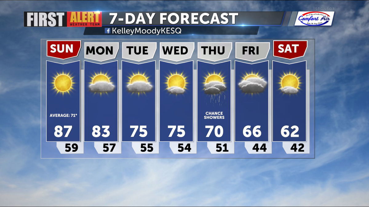
While we will maintain our above normal temperatures through the weekend and into the start of next week, the long-term plan includes a cooldown, more wind, and the chance for rain.
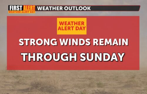
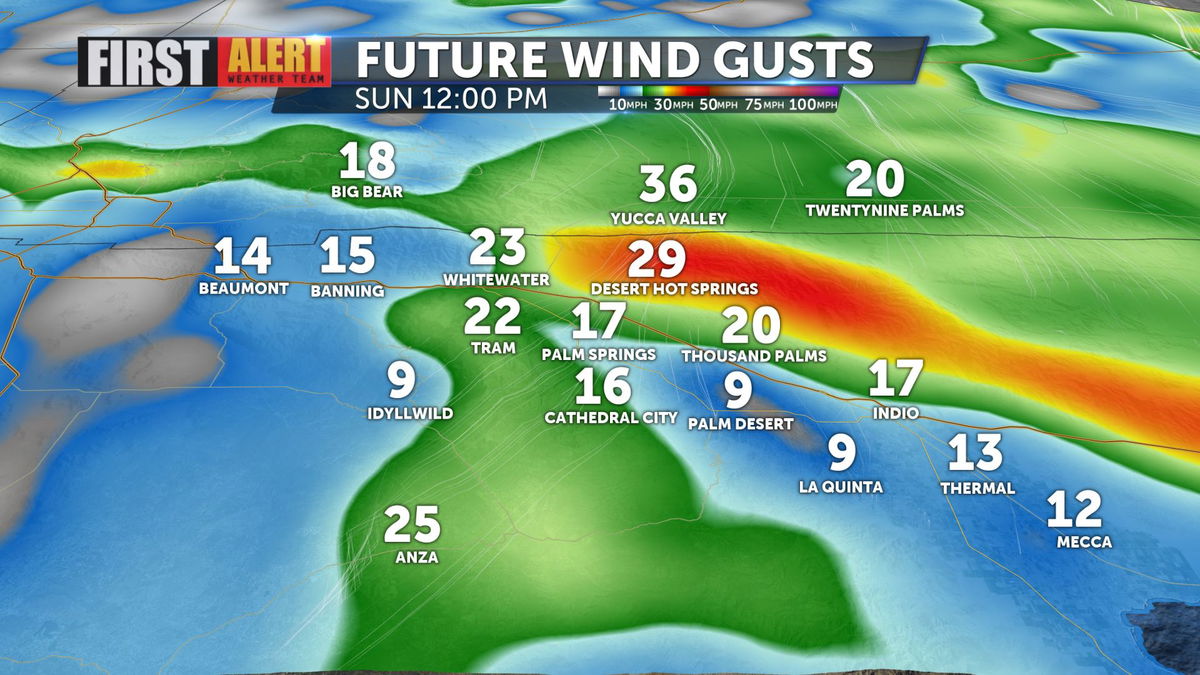
Winds will mostly remain light and breezy this weekend, but offshore winds are expected to strengthen for areas north of I-10 by Sunday afternoon. Peak wind gusts of 30 mph are possible for spots like Desert Hot Springs.
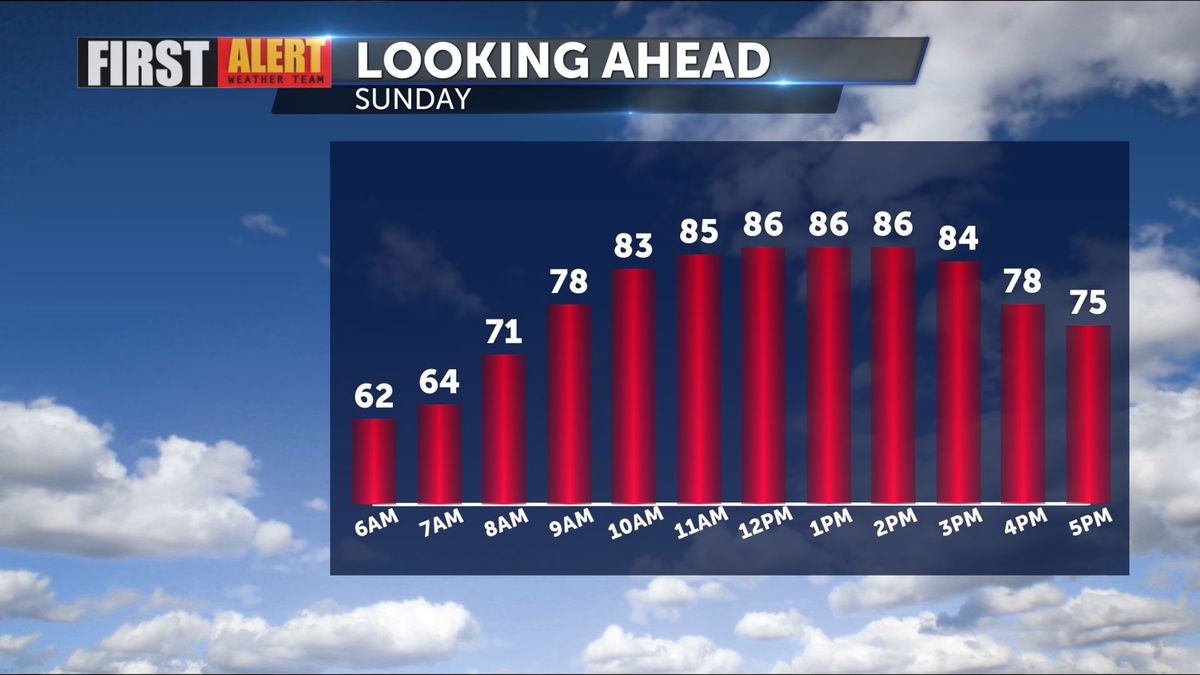
Warmer, drier air from those winds will lead to another day in the mid to upper 80s across the valley by Sunday, just shy of record temperatures.
Winds will change directions to have a more onshore pattern as we move toward the start of the workweek. This will result in temperatures dropping down to the 70s by Tuesday.
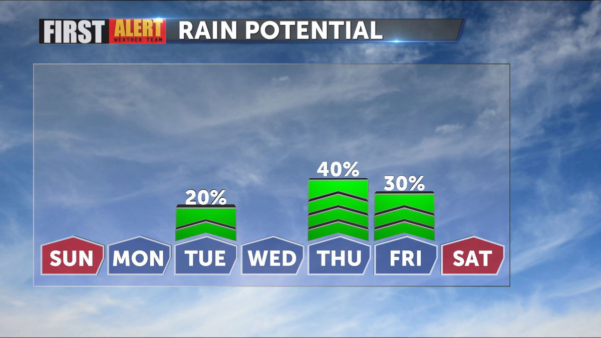
Meanwhile, a system passes over the region that could drop a few midweek raindrops on the valley, though rain is more likely when a second system moves across our area on Thursday. While specific timing is hard to say this far out, it appears the rain will last through the overnight hours and taper Friday morning.
Cool, wet air will have temperatures all the way down to the 60s by this time next week.