
Rain in the forecast presents new threat to wildfire burn scars, mountain communities
As temperatures begin to cool down there are chances of rain throughout parts of Southern California in the next coming days.
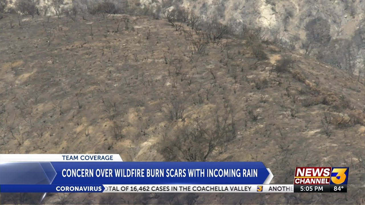
The possible rain has raised concerns over areas that were ravaged by wildfires, including parts of San Bernardino County and Riverside County.
You can get constant weather information anytime with the KESQ First Alert Weather App. You download it for free on the Apple Store or Google Play.
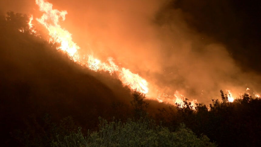
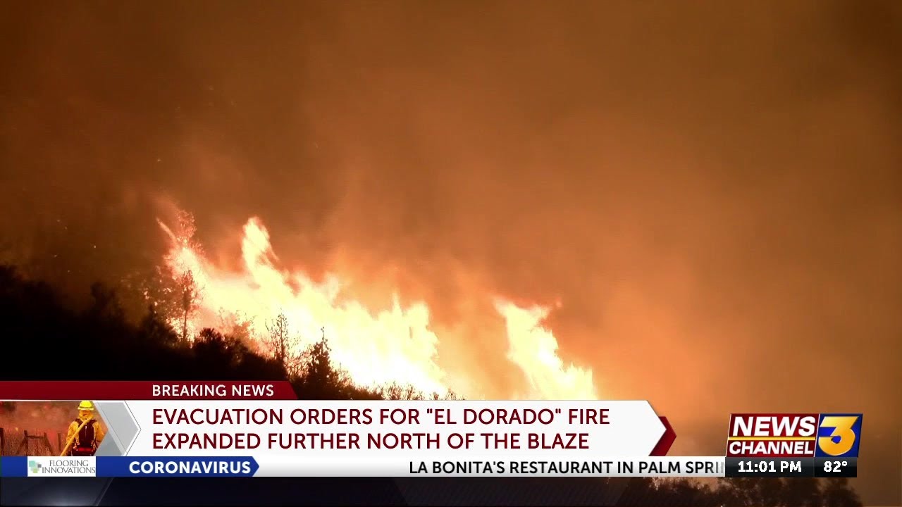
The El Dorado Fire burned 22,744 acres after it broke out on September 5. Just days earlier, the Apple Fire burned 33,424 nearby.

Both areas have been left with debris and charred remains of brush. Future rains could threaten the same mountain area with the potential to bring mudslides and other issues.
"The vegetation that holds that soil in place is no longer there so you're going to have the potential for soil to move," said Riverside County Emergency Management Department Senior Public Information Specialist, Shane Reichardt. "The heat and the oils, everything off the vegetation makes the soil what they call hydrophobic so it doesn't absorb water the way it did previously."
Reichardt is now working with several other agencies to help mitigate future problems.
"National Weather Service is telling us that they're not anticipating them to hit the thresholds. Unfortunately just like any other storm we watch it constantly. Those conditions can change at any other time," Reichardt said.
Back in September, the fire came dangerously close to several shops and restaurants.
"We are preparing for potential flooding," said Devon Riley, owner of Riley's Farm at Los Rios Rancho.
Riley's Farm was rocked not just by COVID-19, but two major wildfires that burned on both sides. In a separate incident, one fire burned down parts of the farm.
"We lost a historic packing house, we lost a cider barn, a workshop, wildlands workshop, store, bakery and cafe," Riley said.
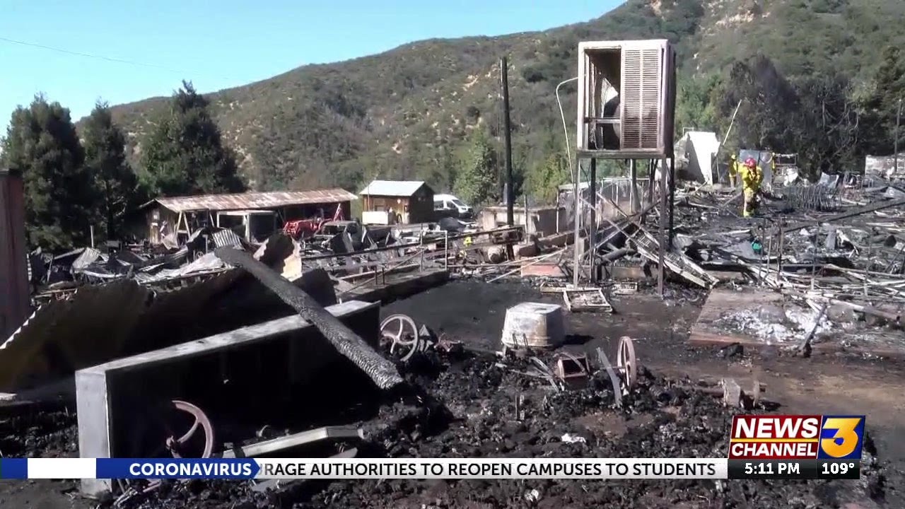
Riley says they are not anticipating much rain, but they are preparing for potential mudslides as a precautionary measure.
"With k-rails in the most strategic places, big concrete barriers in front of our Wilshire operations. My dad has a bunch of sandbags, we've tried partitioning some areas off," Riley said. "The danger is because of the steepness of the mountain behind us."
In unincorporated Palm Springs, where the Snow Fire burned, residents of Snow Creek Village that were evacuated in September told News Channel 3 that they're prepared.
"Full of sand and stuff but it's all been cleaned out. All the debris the water should flow in its natural path again like it did years ago so we've done the best we could in making stuff we prepared for this," one resident told News Channel 3.

"For anyone that is traveling through the forest- they need to be aware that this storm is coming in with rain, and at higher elevations we're going to get snow. That means in some areas, especially the fire scar burn areas, we may see some rock slides or debris flow coming onto your routes of travel. Especially for Highway 38 where the El Dorado Fire burned along it, expect delays and possibly even plan your route if you're coming to the mountains, around it," said San Bernardino National Forest Public Affairs Officer, Zach Behrens.
Residents are also asked to sign up for AlertRivCo to get information of evacuations, and other information. Click here to sign up.
