Warmer than usual temperatures dominate the Coachella Valley

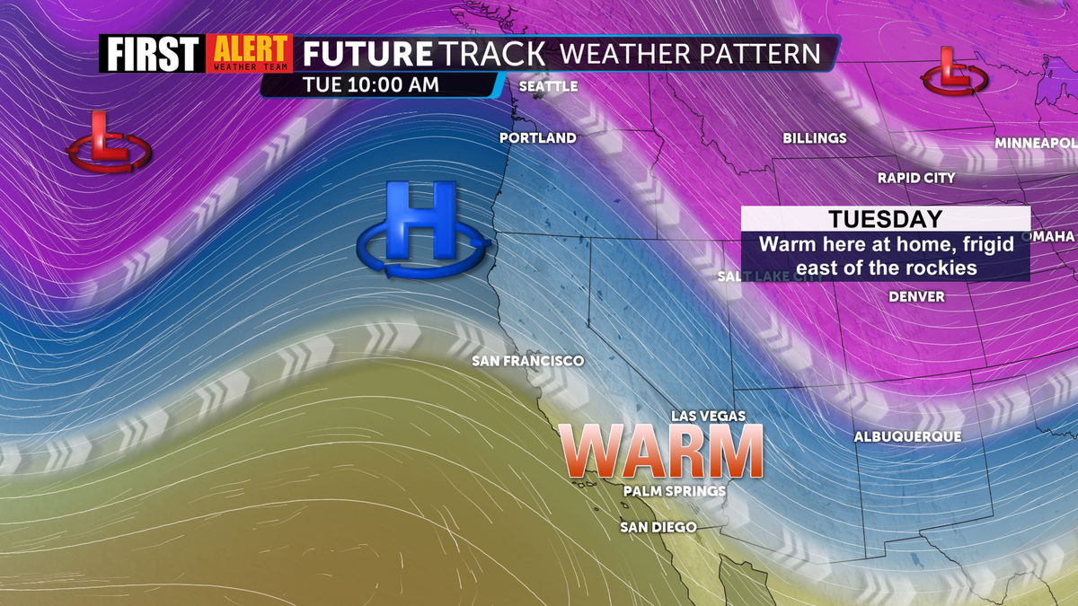
High pressure continues to spread into the west coast today. This is allowing our temperatures to consistently reach the 80s to start the workweek. This wave pattern (trough and ridge) is fairly "high amplitude". This means the high pressure is reaching far to the north and it's also allowing the jetstream to dip farther south than usual east of the rockies, bringing frigid temperatures to millions of people.
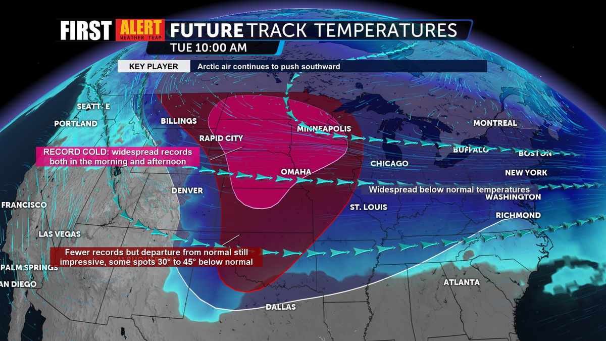
This graphic shows us just how widespread this intense cold is. Sub-freezing temperatures are being felt from Texas all the way to the Northeast with the most intense cold impacting the plains. Wind chills in some areas have the potential to exceed 50 degrees below zero, breaking records along the way.
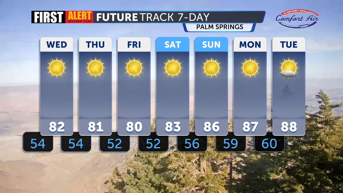
It's thankfully a very different story here at home. Highs will stay in the low 80s for the workweek with a warmup arriving this weekend. We can look forward to highs in the upper 80s to start off next week with the potential to reach the first 90° day of 2025... in February! Stay tuned!