
Weather

Warm through tomorrow with gusty winds returning this weekend
A ridge of high pressure remains over the Western U.S. will hold in place through tomorrow but then gradually weaken into the weekend. The ridge will keep us sunny and mild through tomorrow, but an area of low pressure develops and moves into the Pacific N.W. bringing gusty winds to the region along with a
Continue Reading
Remaining warm for the rest of the week
We remain in the midst of a warming trend through the workweek. High temperatures for Thursday will be in the upper 80s, potentially pushing 90° for some spots in the east valley. We have a ridge of high pressure to thank for the warmer temperatures. However, an area of low pressure will move down the
Continue Reading
Warm end to the week, windy weekend
High pressure building in will keep us slightly warmer than normal through Friday, with changes arriving on Saturday. The ridge of high pressure will push temps to the middle 80s through Friday, with cooler and windier conditions moving in Saturday & Sunday. Highs today will hit 85, besting the 84 reading of yesterday. Today is
Continue Reading
Weather Insider: El Niño update – March 2024
The Climate Prediction Center, a branch of the National Weather Service, issues periodic updates on El Niño conditions in the equatorial Pacific. As a reminder, El Niño is just one phase of a larger cycle called ENSO (El Niño Southern Oscillation). We have been in El Nino conditions since the late spring/early summer of 2023,
Continue Reading
A seasonable start to the spring season
As the low pressure system continues moving off to the east, we are seeing a slight drying of conditions here on the valley floor. Dew points today are in the 30s and 40s while relative humidity values are in the 20s. Looking at the weather pattern for tomorrow, we see a general area of high
Continue Reading
Showers still linger this morning
A cut-off low continues to impact the valley with showers and even the potential for more thunderstorms into today as it lingers just to our East. High pressure will gradual ease that low farther East, allowing us to clear out tonight into tomorrow. Showers are likely to linger, especially in our local mountains, but we
Continue Reading
A cloudy and rainy start to the week
We’ve seen a few storms move across the Coachella Valley throughout the day. As of 5:15 PM on Monday, La Quinta is now leading the valley in terms of rainfall totals with 0.17 inches. Thermal and Palm Desert are both at just over a tenth of an inch and the rest of the valley has
Continue Reading
Weather Insider: Blocking patterns
Most weather patterns are quite transient and don’t stick around for very long. But sometimes a weather pattern can form which serves as a block and can stick around for a few days or more. There are three main types of blocking patterns. The first is called a blocking high and is most common in
Continue Reading
Low pressure still lingering nearby impacting our forecast
The area of low pressure remains just to our East, bringing a bit of instability and the very small chance of showers or isolated thunderstorms today. Moisture sweeping around that cut-off low will offer a very slight chance of those showers and keep us below average in the temperature department, too. Highs will be running
Continue Reading
Sunnier and drier for St. Patrick’s Day
Mostly sunny skies are expected for Sunday although spotty showers will remain possible for local mountains and the High Desert. Today will be noticeably warmer than yesterday as daytime highs reach the upper 70s. This is great news if you have any outdoor St. Patrick’s Day plans! A Winter Storm Warning will expire at 8
Continue Reading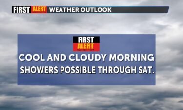
Showers remain possible through Saturday, drier conditions to follow
Light showers and isolated thunderstorms will remain possible through Saturday evening due to a lingering low pressure system that is ushering more moisture into the region. Mostly sunny skies and drier conditions are expected for Sunday as the low pressure system departs east. A Winter Storm Warning will remain in effect for local mountain areas
Continue Reading
Closing out the week with clouds, showers, and chilly temperatures
A Winter Storm Warning is currently in place for the local mountains for elevations above 5,500 feet. Periods of heavy snow may lead to several inches of snow accumulating. 1-3 inches are possible between 5,000 and 7,000 feet and 4-7 inches are possible above 7,000 feet. A low pressure system has been cut off from
Continue Reading
Showers linger as low pressure hovers to our East
An area of low pressure is positioned just to the East of the Valley, and it continues to funnel in light precipitation throughout the region. Overnight, the Valley picked up some significant rainfall, including nearly a third of an inch in Indio. A Winter Storm Warning remains in effect in our local mountains until 6
Continue Reading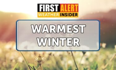
Weather Insider: The warmest winter on record for the continental United States
A new report from NOAA (National Oceanic and Atmospheric Administration) has found that the 2023-2024 meteorological winter was the warmest on record for the continental United States. As a reminder, meteorological winter runs from December through February. The average temperature for the season was 37.6°F – 5.4° above average. This was the warmest winter on
Continue Reading
Weakening wind tonight; rain and snow move into the picture
The gusty winds felt this morning have weakened, and it is now just breezy for Thursday night. As a result, air quality has improved across the Coachella Valley. Now, the focus shifts from wind to wet weather! A Winter Weather Advisory is now in effect for San Bernardino and Riverside County mountains for elevations above
Continue Reading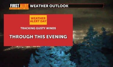
First Alert Weather Alert: Stronger winds arrive
Blowing sand and dust has impacted parts of the Coachella Valley throughout the day. We will continue to monitor air quality through this evening as the winds taper off. While winds will continue to diminish throughout the evening, some lingering breezes or gusts are possible. Today, Palm Springs saw a gust of 45 MPH. This
Continue Reading

Gusty winds creating visibility issues
A strong front is pushing through California, and it means gusty conditions will prevail all the way through Thursday. A High Wind Warning is in place for the Inland Empire, and a Wind Advisory for the Pass and high desert. Reduced visibility has closed roads in Palm Springs around the Whitewater Wash, and the winds
Continue Reading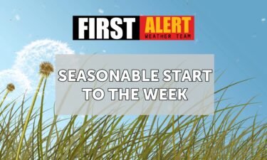
A seasonable start to the week
To start off the week, we have a return to some onshore flow. This helped to usher in some upper-level clouds throughout the morning and early afternoon. Onshore flow will strengthen on Tuesday leading to some stronger breezes and more clouds. A Wind Advisory has been issued by the National Weather Service for the High
Continue Reading