
Weather

Gusty winds and cooler temps in the forecast
Winds have increased and we are seeing some blowing sand and dust as well. A Wind Advisory will be in effect from 4 a.m. until Noon Friday, so the First Alert Weather Team has issued a First Alert Weather Alert for much of the day tomorrow. A large area of low pressure is bringing both
Continue Reading
Tracking the latest cooling trend
This latest cooling trend has arrived! Temperatures today are in the mid-low 90s with a hint of humidity in the air. Winds should not be a major part of the weather story today, but that still may become elevated in some areas. A large trough of low pressure has moved into the Pacific Northwest and
Continue Reading
Cooling continues through the weekend
A series of strong troughs moving through the Pacific Northwest will bring cooler and more comfortable temps through the weekend. The Jetstream is repositioning as well, helping to bring more autumnal conditions, compared to the record-setting heat of last week. The coolest days of this week will be Friday and Saturday, with milder, closer to
Continue Reading
Similar to yesterday, more changes to come
Conditions today are fairly similar to yesterday, if not slightly cooler. We are tracking a tad bit more humidity today with another round of elevated winds. However, there are a number of changes associated with the cooldown to come this week. An area of low pressure will move into the Pacific Northwest tomorrow. This will
Continue Reading
Temps are gradually cooling
Highs are finally moving back toward near normal as we head through this week, but we are still running about 5 degrees above normal today. A trough to the North will bring breezy and cooler conditions through the week, ushering in highs in the 80s by week’s end. Winds will increase through tomorrow evening and
Continue Reading
Finally feeling cooler weather, more cooling on the way
Tonight a once-in-a-lifetime comet will be visible yet again in the sky. Tonight will be nice and clear so look toward the west shortly after sunset. This comet won’t return to Earth for another 80,000 years! Don’t forget to send your pictures to share@kesq.com. We aren’t tracking any major changes to the weather pattern until
Continue Reading
Finally some cooler weather arrives
Breezy conditions this morning as ushering some cooler conditions for the week. Highs today will still be a few degrees above average, but we’re likely not to reach triple digits! A trough moving across the Pacific Northwest will introduce more seasonal numbers through the week. The change is part of a larger atmospheric change, as
Continue Reading
Consistent temperatures for start of the week, but cooling further by mid-week
Highs across the Coachella Valley have been feeling more comfortable with each passing day. While high temperatures will hold near 98° for the start of the week, more cooling is on the way! Conditions will be slightly more humid as we start the week. Dew points were mostly in the 20s and 30s over the
Continue Reading
Triple-digit heat fading as cooling trend continues
It’s been getting more and more comfortable here in the Coachella Valley as the long-awaited cooling trend brings us closer to our seasonal average. Yesterday, we recorded a high of 103° in Palm Springs. We were once again in the triple-digits today, but as the cooling trend continues, we can expect to dip below 100°
Continue Reading
Cooling trend resumes today as temperatures fall through the weekend
A trough of low pressure is moving approaching Northern California. This is reviving the cooling trend on the valley floor after a bit of a break yesterday. This system will cause temperatures to gradually cool into next week. Tonight we are still tracking a large geomagnetic storm. This storm caused auroras to be seen by
Continue Reading
Gradual cooling continues into the weekend
High pressure continues to produce hotter than normal temps; we are seeing a gradual but steady decline in daytime highs. The heatwave across the Western U. S. is finally easing, however there are still areas with temps running 10 degrees above seasonal averages. Temps will eventually drop to the middle 90s through the middle of
Continue Reading
Continuing to track a gradual cool down
Conditions today are overall quite similar to yesterday, however, that won’t stay the case. Tomorrow, we will resume our cooling trend as high temperatures fall slightly. Temperatures will continue to fall in the days through the weekend. Taking a look at the drought monitor, we see increasingly dry conditions across the state and more drought
Continue Reading
Cooling trend underway
Highs are finally dropping toward more seasonally normal conditions, topping out at 104 yesterday. We will still be ten or so degrees above normal this afternoon. Air quality may be an issue today in the Imperial Valley, with an Air Quality Alert for elevated ozone levels in place there through this evening. So far, air
Continue Reading
Continuing to track cooler conditions this week
Temperatures today have fallen a bit more than initially expected, which is some very welcomed news! There are no more excessive heat warnings or heat advisories in place for the Coachella Valley or the rest of Southern California. Thanks to our weather pattern set up, we will slowly start to feel more relief day by
Continue Reading
Heatwave slowly ebbing
The Excessive Heat Warning expired yesterday evening, but we are still flirting with near-record heat today as a slow cool-down begins. The record today is 110 degrees and I think we’ll be just shy of that later this afternoon. A trough up to our North will finally bring some cooler conditions through the end of
Continue Reading
Tracking a very very slow cooling trend this week
Our Excessive Heat Warning will remain in place through 8 PM this evening as highs approach 110°. This advisory has not been extended, but temperatures will stay hot over the next few days so be sure to always practice heat safety! Thanks to a trough of low pressure, we are in the midst of a
Continue Reading
Heat continues but relief is in sight
We topped out at another record high Monday afternoon, hitting 113 degrees, besting the previous record of 111 set in 1996. Because the record threat isn’t over, the Excessive Heat Warning has been extended through this evening. Blistering temps will be the norm again today across the Western U. S. as high pressure continues to
Continue Reading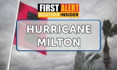
Weather Insider: Tracking Hurricane Milton
The graphic below shows the IR (infrared) satellite imagery from Hurricane Milton, now an extremely strong category 5 storm. The most prominent feature of the storm, as will all mature hurricanes, is the eye in the middle of the storm. The extremely tight eye signifies exceptionally strong winds. This storm has undergone “extreme rapid intensification”
Continue Reading