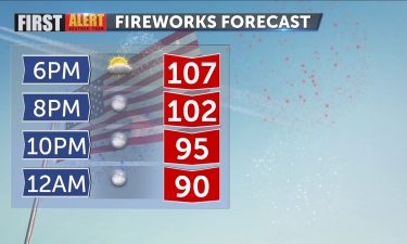
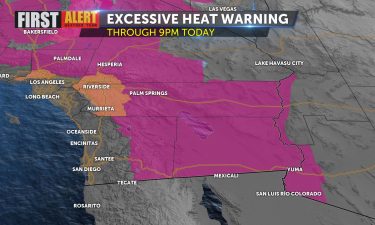
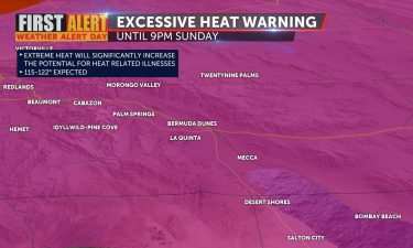
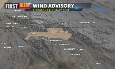
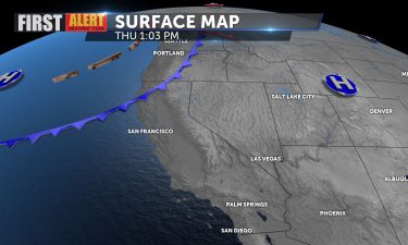
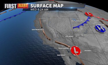
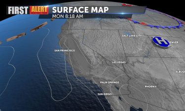
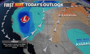
Skip to Content

KESQ Weather

Warmer and drier for the weekend

Dew points are starting to fall a bit this morning as the atmosphere slowly dries out. Moisture is still gradually moving eastward. Daytime highs will top out near 110 for the next several days, and humidity values should be slightly lower than they were all week. This means you should be able to use evaporative

Continue Reading

Another day of humidity

Thunderstorms still popping up to the north and east of the Valley with a very active cell this morning near Lake Havasu. You can see the frequent lightning strikes happening. Humidity remains thick across the region this morning, and it will linger through the day, much like yesterday, but the impetus for storms seems to

Continue Reading

Heat drops, humidity increases

It’s not the heat, it’s the humidity (at least today and tomorrow). Monsoon moisture is on the increase, already dropping temps in the valley after clocking at high of 117 yesterday (just below the 118 record). Humidity will make it less comfortable today, despite the cooler highs. Evaporative coolers won’t work well today, and you

Continue Reading

Heating up again to start the week

Yesterday’s record setting 121 degree high won’t be repeated today in all likelihood, but it will be another scorcher. We remain under an Excessive Heat Warning through 9 p.m. as highs soar into the one-teens today. The Pacific NW also is strained under a withering heatwave to our North as well. The ridge of high

Continue Reading

Excessive heat is back

The heat is back. Palm Springs hit a high of 116° on Saturday. It’s because of a ridge of high pressure over the Pacific Northwest. An Excessive Heat Warning goes into effect Sunday morning through Monday night for the Coachella Valley and surrounding areas. Temperatures are expected to reach up to 117°. A Heat Advisory

Continue Reading

First Alert Weather Alert this week for dangerous heatwave

WHY THE FIRST ALERT WEATHER ALERT: Excessive heat continues for much of the Desert Southwest to end the weekend. We set records Thursday, Friday, and Saturday for multiple valley locations. This ridge is slowly weakening but still bringing extreme heat through Father’s Day weekend. That ridge is also pulling moisture up from the Southeast, so

Continue Reading

Mild with partly cloudy skies today

Clouds are lingering across the region today, streaming in from the southwest and helping to keep temps below seasonal averages. Those clouds will gradually clear out late this afternoon. High temperatures will again be below average, the air mass in place remains fairly cool and comfortable. All week we’ve enjoyed highs in the 90s, and

Continue Reading

Another cooler-than-normal day ahead

Gusty conditions overnight lead to the closure of Gene Autry at Via Escuela again this morning, but the previously posted Wind Advisory has ended. It will remain breezy today, with those sundowner winds continuing. A weak front to our North will provide the impetus for the wind, but also keep us cooler than normal (102)

Continue Reading

Cooling down through the weekend

It was another above average day. Palm Springs recorded a high temperature of 108°. That’s 1° cooler than yesterday. The heat continues this evening with a breeze to provide some relief. Gustier winds pick up this evening for the more wind-prone locations through the San Gorgonio pass and along the I-10. Tomorrow will be closer

Continue Reading

Breezy again this evening

Yesterday winds reached 28mph gusts in Palm Springs, 33mph gusts in Thousand Palms, with blowing sand prompting the closure of Gene Autry (now reopened). Winds again this evening will be similar. A persistent trough up North is fueling those winds, and they will be strongest in the “sundowner” timeframe. High again are approaching triple digits,

Continue Reading

Overnight cloud cover moves out

Sunny skies greeted us this morning, despite some clouds overnight that ruined our view of the total lunar eclipse early this morning. We’ll continue to enjoy sunshine throughout the day as the Futurecast data shows. A weak trough in place should keep us slightly cooler than yesterday’s 102 reading. Dew points remain low despite those

Continue Reading

Highs threaten triple digits today

We will be slightly above seasonal averages today (97) with temps likely hitting 100 this afternoon. Yesterday we topped out at 98. We do expect some breeziness later this afternoon and early evening. With above average temps and gusty conditions around, fire danger is higher than usual, especially in some areas to our North where

Continue Reading

Gusty start to the weekend

A Wind Advisory remains in effect until 11 p.m. and the Red Flag Warning is now in effect until 8 p.m. this evening, so those are signs that things are calming down slowly. A large, cool area of low pressure dominates the Western US, keeping us windy but well below average in terms of temperature

Continue Reading